Approximate Location Map
Large Map »
Latitude: 51.0198 / 51°1'11"N
Longitude: -3.1066 / 3°6'23"W
OS Eastings: 322477
OS Northings: 125075
OS Grid: ST224250
Mapcode National: GBR M1.J0SC
Mapcode Global: FRA 46CF.5J7
Plus Code: 9C3R2V9V+W9
Entry Name: Elms Parade
Listing Date: 4 July 1975
Grade: II
Source: Historic England
Source ID: 1059933
English Heritage Legacy ID: 269902
ID on this website: 101059933
Location: North Town, Somerset, TA1
County: Somerset
District: Somerset West and Taunton
Electoral Ward/Division: Taunton Fairwater
Parish: Non Civil Parish
Built-Up Area: Taunton
Traditional County: Somerset
Lieutenancy Area (Ceremonial County): Somerset
Tagged with: Building
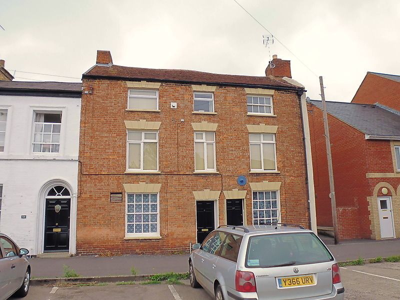
1. STAPLEGROVE ROAD
5365
(North-East Side)
Nos 4A and 4
ST 2224 6/375
II GV
2.
Part of a terrace known as Elms Parade and set back from the road. Probably early
C19. 3 storeys. Red brick. Old tile roof. Painted and banded lintels with keystones.
3 windows, some origional sashes with glazing bars. Pair of doorways in centre,
No 4 with 6-panel door. Included for group value.
Nos 4A and 4 to 3 (even) form a group.
Listing NGR: ST2247425078
External links are from the relevant listing authority and, where applicable, Wikidata. Wikidata IDs may be related buildings as well as this specific building. If you want to add or update a link, you will need to do so by editing the Wikidata entry.


Other nearby listed buildings
