Approximate Location Map
Large Map »
Latitude: 51.3486 / 51°20'55"N
Longitude: 0.7327 / 0°43'57"E
OS Eastings: 590398
OS Northings: 164608
OS Grid: TQ903646
Mapcode National: GBR RT6.638
Mapcode Global: VHKJL.NC6G
Plus Code: 9F328PXM+F3
Entry Name: 64 and 66, High Street
Listing Date: 13 December 1974
Grade: II
Source: Historic England
Source ID: 1061056
English Heritage Legacy ID: 175754
ID on this website: 101061056
Location: Milton Regis, Swale, Kent, ME10
County: Kent
District: Swale
Electoral Ward/Division: Milton Regis
Parish: Non Civil Parish
Built-Up Area: Sittingbourne
Traditional County: Kent
Lieutenancy Area (Ceremonial County): Kent
Tagged with: Building
1.
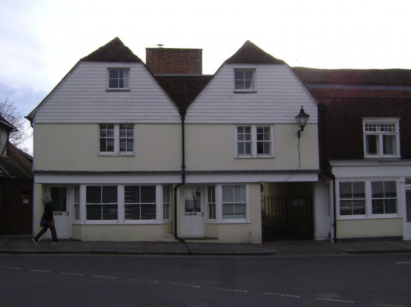
5282 HIGH STREET
(East side)
MILTON REGIS
Nos 64 and 66
TQ 9064 NW 1/133
II GV
2.
C18 with mid Cl9 facade. 2 storeys and attics pebbledashed. Tiled roof in 2 hips
to front elevation. 2 altered windows and later shop front. Grade II for group
value.
Nos 52 to 76 (even), 80 to 104 (even), 104A and ll0 form a group.
Listing NGR: TQ9039864608
External links are from the relevant listing authority and, where applicable, Wikidata. Wikidata IDs may be related buildings as well as this specific building. If you want to add or update a link, you will need to do so by editing the Wikidata entry.


Other nearby listed buildings
