Approximate Location Map
Large Map »
Latitude: 51.0956 / 51°5'44"N
Longitude: 0.5322 / 0°31'55"E
OS Eastings: 577406
OS Northings: 135974
OS Grid: TQ774359
Mapcode National: GBR PTC.9C7
Mapcode Global: FRA D607.74G
Plus Code: 9F323GWJ+7V
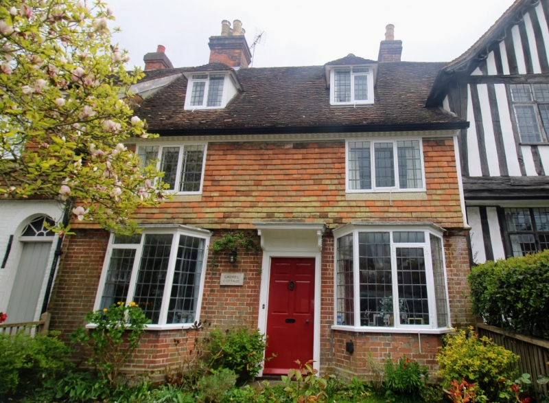
Entry Name: Laurel Cottage
Listing Date: 20 June 1967
Grade: II
Source: Historic England
Source ID: 1063711
English Heritage Legacy ID: 169000
ID on this website: 101063711
Location: Cranbrook, Tunbridge Wells, Kent, TN17
County: Kent
District: Tunbridge Wells
Civil Parish: Cranbrook & Sissinghurst
Built-Up Area: Cranbrook
Traditional County: Kent
Lieutenancy Area (Ceremonial County): Kent
Tagged with: Cottage
CRANBROOK HIGH STREET
TQ 7735 NW
(south side)
11/151
Laurel Cottage
20.6.67
GV II
Cottage. C17, clad in C18. Timber framed and faced in red brick. Wooden den-
tilled eaves cornice to plain tiled roof. Brick ridge stack to left and stack
behind ridge to right. 2 hipped dormers. 2 storeys and attics. 2 window
front, casements, those on ground floor large. Boarded door to right of centre
with small flat hood on brackets over.
Listing NGR: TQ7740735971
External links are from the relevant listing authority and, where applicable, Wikidata. Wikidata IDs may be related buildings as well as this specific building. If you want to add or update a link, you will need to do so by editing the Wikidata entry.


Other nearby listed buildings
