Approximate Location Map
Large Map »
Latitude: 51.5171 / 51°31'1"N
Longitude: -0.089 / 0°5'20"W
OS Eastings: 532693
OS Northings: 181530
OS Grid: TQ326815
Mapcode National: GBR SB.5B
Mapcode Global: VHGR0.D4T9
Plus Code: 9C3XGW86+RC
Entry Name: 63-73, Moorgate EC2
Listing Date: 5 June 1972
Grade: II
Source: Historic England
Source ID: 1064584
English Heritage Legacy ID: 199654
ID on this website: 101064584
Location: City of London, London, EC2R
County: London
District: City and County of the City of London
Electoral Ward/Division: Coleman Street
Parish: Non Civil Parish
Built-Up Area: City of London
Traditional County: Middlesex
Lieutenancy Area (Ceremonial County): City of London
Church of England Parish: St Margaret Lothbury
Church of England Diocese: London
Tagged with: Building
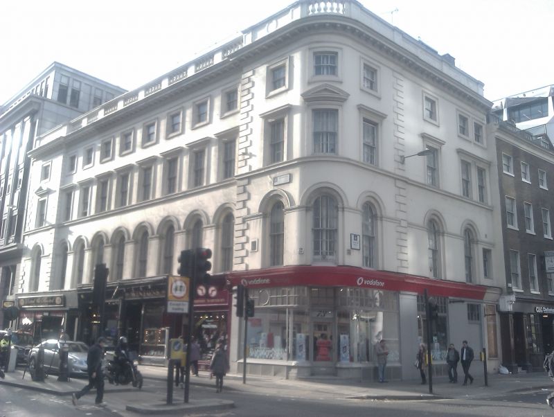
MOORGATE EC2
1.
5002
(West Side)
Nos 63 to 73 (odd)
TQ 3281 NE 4/42 5.6.72.
II GV
2.
Early/mid C19. Stuccoed terrace of 4 storeys with rounded corner and short return
to London wall. Arched lst floor windows, with dressing above and modillion cornice
plus part parapet, part balustrade.
Listing NGR: TQ3269081523
External links are from the relevant listing authority and, where applicable, Wikidata. Wikidata IDs may be related buildings as well as this specific building. If you want to add or update a link, you will need to do so by editing the Wikidata entry.


Other nearby listed buildings
