Approximate Location Map
Large Map »
Latitude: 51.4851 / 51°29'6"N
Longitude: -0.2792 / 0°16'45"W
OS Eastings: 519578
OS Northings: 177647
OS Grid: TQ195776
Mapcode National: GBR 8T.09M
Mapcode Global: VHGQX.3XRW
Plus Code: 9C3XFPPC+38
Entry Name: 28 and 29, Strand on the Green W4
Listing Date: 21 May 1973
Grade: II
Source: Historic England
Source ID: 1067516
English Heritage Legacy ID: 438643
ID on this website: 101067516
Location: Strand on the Green, Hounslow, London, W4
County: London
District: Hounslow
Electoral Ward/Division: Chiswick Riverside
Parish: Non Civil Parish
Built-Up Area: Hounslow
Traditional County: Middlesex
Lieutenancy Area (Ceremonial County): Greater London
Church of England Parish: St Paul Chiswick Grove Park
Church of England Diocese: London
Tagged with: Building
1.
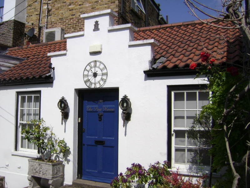
4419 STRAND ON THE GREEN W4
Nos 28 & 29
TQ 1977 NE 3/92B
II
2.
C18 houses, much altered. 2 storeys. 4 windows. Stuccoed. Parapets.
Windows, altered and various projections built out.
Listing NGR: TQ1957877647
External links are from the relevant listing authority and, where applicable, Wikidata. Wikidata IDs may be related buildings as well as this specific building. If you want to add or update a link, you will need to do so by editing the Wikidata entry.


Other nearby listed buildings
