Approximate Location Map
Large Map »
Latitude: 51.3164 / 51°18'58"N
Longitude: 0.8892 / 0°53'21"E
OS Eastings: 601435
OS Northings: 161439
OS Grid: TR014614
Mapcode National: GBR SW3.HLR
Mapcode Global: VHKJW.C5FP
Plus Code: 9F328V8Q+HM
Entry Name: 104, West Street
Listing Date: 3 August 1972
Grade: II
Source: Historic England
Source ID: 1067604
English Heritage Legacy ID: 438557
ID on this website: 101067604
Location: Faversham, Swale, Kent, ME13
County: Kent
District: Swale
Civil Parish: Faversham
Built-Up Area: Faversham
Traditional County: Kent
Lieutenancy Area (Ceremonial County): Kent
Tagged with: Building
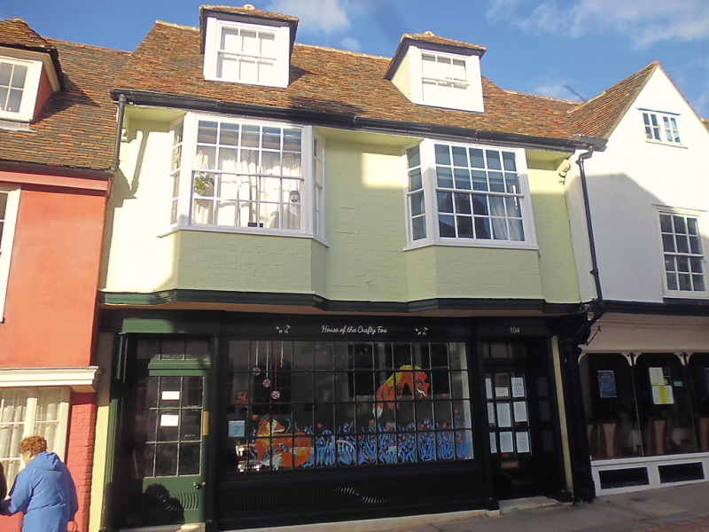
WEST STREET
1.
l103 (North Side)
------------
TR 0l6l SW 2/133
II GV
2.
Similar Cl7 building, but with higher elevation aid attic storey with
2 hipped dormers. Ground floor modern shop front, now boarded up; above
painted brick with 2 bays, their glazing bars intact.
Nos 102 to 107 (consec) form a group.
Listing NGR: TR0143661446
External links are from the relevant listing authority and, where applicable, Wikidata. Wikidata IDs may be related buildings as well as this specific building. If you want to add or update a link, you will need to do so by editing the Wikidata entry.


Other nearby listed buildings
