Approximate Location Map
Large Map »
Latitude: 51.3161 / 51°18'57"N
Longitude: 0.8902 / 0°53'24"E
OS Eastings: 601506
OS Northings: 161407
OS Grid: TR015614
Mapcode National: GBR SW3.HVJ
Mapcode Global: VHKJW.C5ZY
Plus Code: 9F328V8R+C3
Entry Name: 116, West Street
Listing Date: 29 July 1950
Grade: II
Source: Historic England
Source ID: 1067607
English Heritage Legacy ID: 438562
ID on this website: 101067607
Location: Faversham, Swale, Kent, ME13
County: Kent
District: Swale
Civil Parish: Faversham
Built-Up Area: Faversham
Traditional County: Kent
Lieutenancy Area (Ceremonial County): Kent
Tagged with: Building
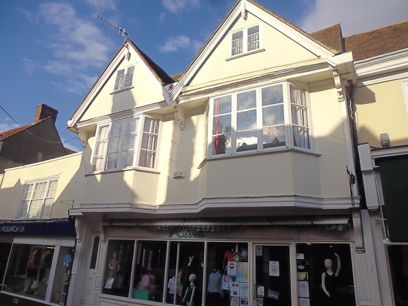
WEST STREET
1.
ll03 (North Side)
------------
No 116
TR 0161 SE 3/137 29.7.50.
II GV
2.
Restored Cl6 timber-framed house. 3 storeys. 2 windows. Plastered
front. The lst floor jettied on bressummer. 2 gables also
overhanging on bressummer and brackets. Tiled roof. 2 bays on
lst floor with modern easement windows in them. Modern shop front.
Nos 114 to 117 (consec) form a group.
Listing NGR: TR0150761409
External links are from the relevant listing authority and, where applicable, Wikidata. Wikidata IDs may be related buildings as well as this specific building. If you want to add or update a link, you will need to do so by editing the Wikidata entry.


Other nearby listed buildings
