Approximate Location Map
Large Map »
Latitude: 51.0667 / 51°4'0"N
Longitude: 1.0842 / 1°5'2"E
OS Eastings: 616184
OS Northings: 134234
OS Grid: TR161342
Mapcode National: GBR V0S.4WQ
Mapcode Global: FRA F659.D72
Plus Code: 9F33338M+MM
Entry Name: 114, Stade Street
Listing Date: 21 December 1973
Grade: II
Source: Historic England
Source ID: 1068926
English Heritage Legacy ID: 175178
ID on this website: 101068926
Location: Hythe, Folkestone and Hythe, Kent, CT21
County: Kent
District: Folkestone and Hythe
Civil Parish: Hythe
Built-Up Area: Hythe
Traditional County: Kent
Lieutenancy Area (Ceremonial County): Kent
Tagged with: Building
1.
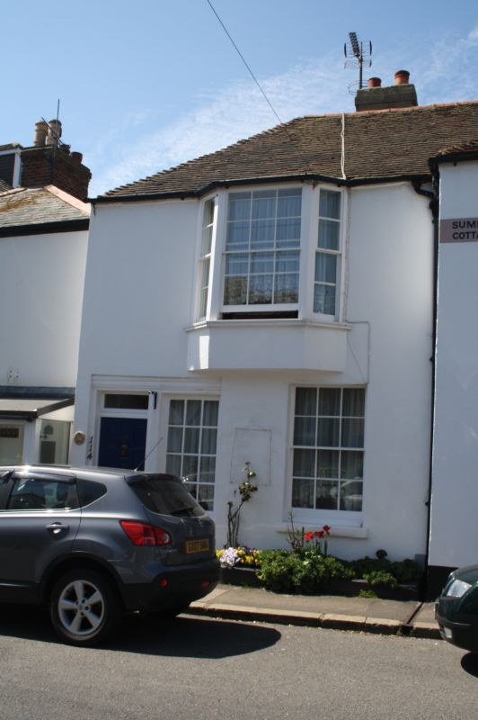
1253 STADE STREET
(South West Side)
No 114
TR 13 SE 5/123
II
2.
Early C19. 2 storeys stuccoed. Hipped tiled roof, 1 3-light bay on 1st floor.
Ground floor has simple doorcase and 2 sashes.
Listing NGR: TR1618434234
External links are from the relevant listing authority and, where applicable, Wikidata. Wikidata IDs may be related buildings as well as this specific building. If you want to add or update a link, you will need to do so by editing the Wikidata entry.


Other nearby listed buildings
