Approximate Location Map
Large Map »
Latitude: 51.072 / 51°4'19"N
Longitude: 1.0872 / 1°5'14"E
OS Eastings: 616375
OS Northings: 134836
OS Grid: TR163348
Mapcode National: GBR V0L.RPL
Mapcode Global: FRA F659.1DC
Plus Code: 9F3333CP+RV
Entry Name: 119-123, High Street
Listing Date: 21 December 1973
Grade: II
Source: Historic England
Source ID: 1068983
English Heritage Legacy ID: 175114
ID on this website: 101068983
Location: Hythe, Folkestone and Hythe, Kent, CT21
County: Kent
District: Folkestone and Hythe
Civil Parish: Hythe
Built-Up Area: Hythe
Traditional County: Kent
Lieutenancy Area (Ceremonial County): Kent
Tagged with: Building
1.
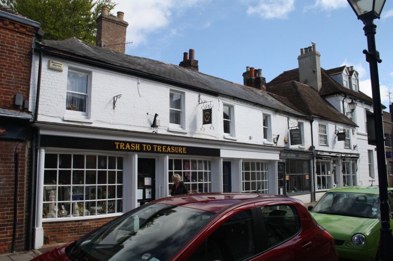
1253 HIGH STREET
(North Side)
Nos 119 to 123 (odd)
TR 1634 NW 2/96
II GV
2.
A mid-C19 range. 2 storeys painted brick. Slate roof with modillion cornice.
5 sashes. Later shop fronts. Nos l19-121 have curved Georgian style shop fronts.
Doorcases have fluted pilasters. The rear elevations have hipped tiled roofs.
Included for group value.
Nos 115 to 125 (odd) form a group.
Listing NGR: TR1636834834
External links are from the relevant listing authority and, where applicable, Wikidata. Wikidata IDs may be related buildings as well as this specific building. If you want to add or update a link, you will need to do so by editing the Wikidata entry.


Other nearby listed buildings
