Approximate Location Map
Large Map »
Latitude: 51.3178 / 51°19'4"N
Longitude: 0.8837 / 0°53'1"E
OS Eastings: 601045
OS Northings: 161580
OS Grid: TR010615
Mapcode National: GBR SW3.879
Mapcode Global: VHKJW.84JM
Plus Code: 9F328V9M+4F
Entry Name: Stonebridge Cottages
Listing Date: 4 May 1970
Grade: II
Source: Historic England
Source ID: 1069452
English Heritage Legacy ID: 175911
ID on this website: 101069452
Location: Davington, Swale, Kent, ME13
County: Kent
District: Swale
Civil Parish: Faversham
Built-Up Area: Faversham
Traditional County: Kent
Lieutenancy Area (Ceremonial County): Kent
Tagged with: Cottage
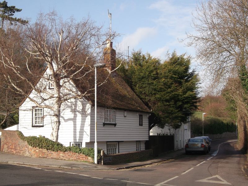
DAVINGTON HILL
1. --------------
ll03
No 1 (Stonebridge Cottages)
TR 0161 NW 7/146 4.5.1O.
II GV
2.
Cl6. Timber-framed cottage fronted with weather-boarding, the 1st floor
jettied on its East side. Tiled roof. 1 sash window with its glazing
bars intact, the others casement windows. 2 storeys. 2 windows.
Nos 1 and Nos 3 to 8 (consec) form a group.
Listing NGR: TR0104361581
External links are from the relevant listing authority and, where applicable, Wikidata. Wikidata IDs may be related buildings as well as this specific building. If you want to add or update a link, you will need to do so by editing the Wikidata entry.


Other nearby listed buildings
