Approximate Location Map
Large Map »
Latitude: 51.2273 / 51°13'38"N
Longitude: 1.4032 / 1°24'11"E
OS Eastings: 637702
OS Northings: 153071
OS Grid: TR377530
Mapcode National: GBR X1R.TW0
Mapcode Global: VHMDG.8FN0
Plus Code: 9F336CG3+W7
Entry Name: 125, Middle Street
Listing Date: 8 February 1974
Grade: II
Source: Historic England
Source ID: 1069793
English Heritage Legacy ID: 177165
ID on this website: 101069793
Location: Deal, Dover, Kent, CT14
County: Kent
District: Dover
Civil Parish: Deal
Built-Up Area: Deal
Traditional County: Kent
Lieutenancy Area (Ceremonial County): Kent
Tagged with: Building
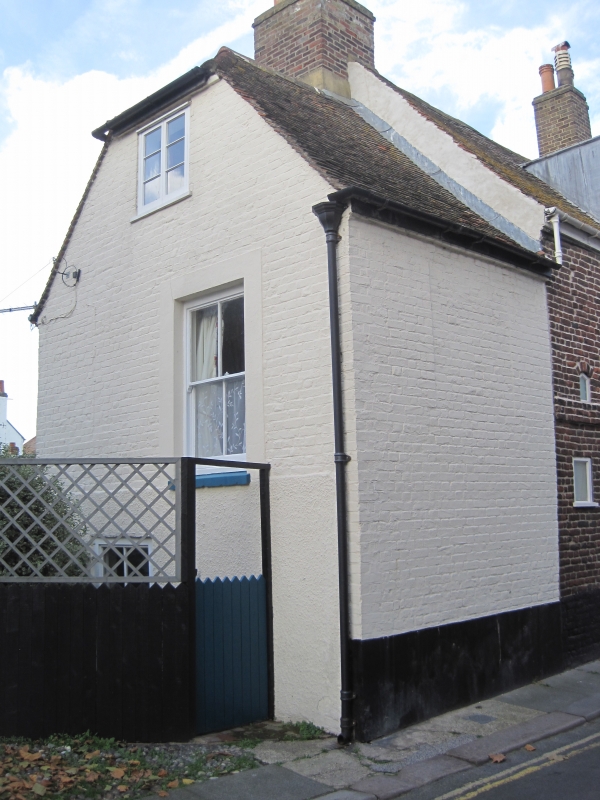
MIDDLE STREET
1.
1035
(West Side)
No 125
TR 3753 SE 2/327
II GV
2.
Early to Mid C19. Entrance on side elevation. 2 storeys and attics red brick,
Half-hipped tiled roof with gable front. 1 casement or sash window. Simple
doorcase with modern glazed surround. The lower portion of the side elevation
is pebble dashed. Plinth. Included for group value.
Nos 123 to 131 (odd) form a group.
Listing NGR: TR3770253071
External links are from the relevant listing authority and, where applicable, Wikidata. Wikidata IDs may be related buildings as well as this specific building. If you want to add or update a link, you will need to do so by editing the Wikidata entry.


Other nearby listed buildings
