Approximate Location Map
Large Map »
Latitude: 51.228 / 51°13'40"N
Longitude: 1.4033 / 1°24'11"E
OS Eastings: 637709
OS Northings: 153153
OS Grid: TR377531
Mapcode National: GBR X1R.TX1
Mapcode Global: VHMDG.8DQF
Plus Code: 9F336CH3+68
Entry Name: 149A, Middle Street
Listing Date: 8 February 1974
Grade: II
Source: Historic England
Source ID: 1069798
English Heritage Legacy ID: 177173
ID on this website: 101069798
Location: Deal, Dover, Kent, CT14
County: Kent
District: Dover
Civil Parish: Deal
Built-Up Area: Deal
Traditional County: Kent
Lieutenancy Area (Ceremonial County): Kent
Tagged with: Building
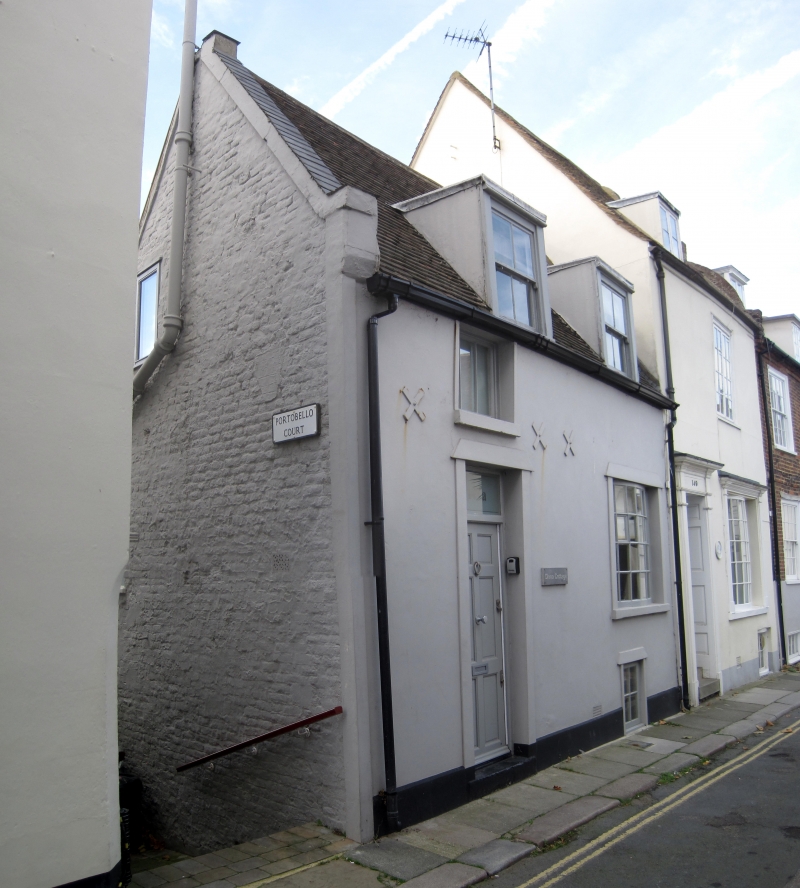
MIDDLE STREET
1.
1035
(West Side)
No 149A
TR 5755 SE 2/331
II GV
2.
Mid C19. 1½ storeys stuccoed. Tiled roof with 2 dormers. Modern Neo-Georgian
bow and doorcase with rectangular fanlight. Included for group value.
Nos 139 to 155 (odd) form a group.
Also No 147 forms a group with Nos 1 to 3 (ccnsec) Portobello Court.
Listing NGR: TR3770953153
External links are from the relevant listing authority and, where applicable, Wikidata. Wikidata IDs may be related buildings as well as this specific building. If you want to add or update a link, you will need to do so by editing the Wikidata entry.


Other nearby listed buildings
