Approximate Location Map
Large Map »
Latitude: 51.2271 / 51°13'37"N
Longitude: 1.4039 / 1°24'13"E
OS Eastings: 637753
OS Northings: 153047
OS Grid: TR377530
Mapcode National: GBR X1Y.1R1
Mapcode Global: VHMDG.9F05
Plus Code: 9F336CG3+RG
Entry Name: Caroline Cottage Margery's Folly
Listing Date: 8 February 1974
Grade: II
Source: Historic England
Source ID: 1069844
English Heritage Legacy ID: 177082
ID on this website: 101069844
Location: Deal, Dover, Kent, CT14
County: Kent
District: Dover
Civil Parish: Deal
Built-Up Area: Deal
Traditional County: Kent
Lieutenancy Area (Ceremonial County): Kent
Tagged with: Building
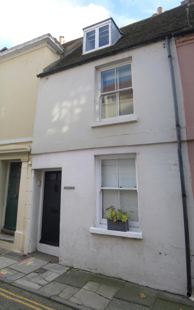
FARRIER STREET
1.
1035
(South Side)
No 18 (Caroline Cottage)
No 20 (Margery's Folly)
TR 3753 SE 2/77A
II GV
2.
C18. 2 storeys and attics stuccoed. Old tiled roof with 1 dormer, 1 sash each.
No 18 has glazing bars intact. No 20 has verticals only. Stringcourse. Simple
doorcase with 6 panelled doors.
Nos 6 to 24 (even) form a group.
Listing NGR: TR3775353047
External links are from the relevant listing authority and, where applicable, Wikidata. Wikidata IDs may be related buildings as well as this specific building. If you want to add or update a link, you will need to do so by editing the Wikidata entry.


Other nearby listed buildings
