Approximate Location Map
Large Map »
Latitude: 51.2293 / 51°13'45"N
Longitude: 1.4029 / 1°24'10"E
OS Eastings: 637676
OS Northings: 153290
OS Grid: TR376532
Mapcode National: GBR X1R.TRQ
Mapcode Global: VHMDG.8CJH
Plus Code: 9F336CH3+P5
Entry Name: 5 and 6, Alfred Square
Listing Date: 8 February 1974
Grade: II
Source: Historic England
Source ID: 1069901
English Heritage Legacy ID: 176926
ID on this website: 101069901
Location: Deal, Dover, Kent, CT14
County: Kent
District: Dover
Civil Parish: Deal
Built-Up Area: Deal
Traditional County: Kent
Lieutenancy Area (Ceremonial County): Kent
Tagged with: Building
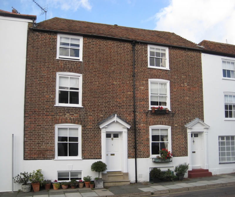
ALFRED SQUARE
1.
1035
(North Side)
Nos 5 and 6
TR 3753 sz 2/171
II GV
2.
An early C19 pair. 3 storeys and basement red brick with rendered basements.
Tiled roof, 1 sash to each with verticals only. Open pedimented doorcases with
panelled reveals and 6 panelled doors.
Nos 1 to 8b (consec) form a group with No 1 Sandown Road.
Listing NGR: TR3767653290
External links are from the relevant listing authority and, where applicable, Wikidata. Wikidata IDs may be related buildings as well as this specific building. If you want to add or update a link, you will need to do so by editing the Wikidata entry.


Other nearby listed buildings
