Approximate Location Map
Large Map »
Latitude: 51.0679 / 51°4'4"N
Longitude: 0.6876 / 0°41'15"E
OS Eastings: 588401
OS Northings: 133274
OS Grid: TQ884332
Mapcode National: GBR QW3.STN
Mapcode Global: FRA D6B9.7R0
Plus Code: 9F323M9Q+43
Entry Name: 2-8, Bell's Lane
Listing Date: 8 June 1972
Grade: II
Source: Historic England
Source ID: 1070359
English Heritage Legacy ID: 179690
ID on this website: 101070359
Location: Tenterden, Ashford, Kent, TN30
County: Kent
District: Ashford
Civil Parish: Tenterden
Built-Up Area: Tenterden
Traditional County: Kent
Lieutenancy Area (Ceremonial County): Kent
Tagged with: Building
1.
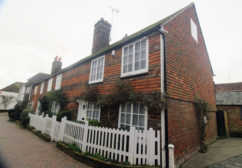
1715 BELL'S LANE
(South West Side)
Nos 2 to 8 (even)
TQ 8833 1/164
II GV
2.
An early C19 terrace. 2 storeys faced with tiles and weatherboarded on
side elevation. Hipped tiled roof with 2 brick stacks. Restored casements.
4 simple doorcases with flat weatherhoods and brackets except to No 8
which has an open pediment. (Graded II as a group.)
Nos 2 to 8 (even) form a group.
Listing NGR: TQ8840133274
External links are from the relevant listing authority and, where applicable, Wikidata. Wikidata IDs may be related buildings as well as this specific building. If you want to add or update a link, you will need to do so by editing the Wikidata entry.


Other nearby listed buildings
