Approximate Location Map
Large Map »
Latitude: 51.1256 / 51°7'32"N
Longitude: 0.7483 / 0°44'53"E
OS Eastings: 592412
OS Northings: 139845
OS Grid: TQ924398
Mapcode National: GBR RWX.B0Y
Mapcode Global: VHKKK.XZG0
Plus Code: 9F324PGX+68
Entry Name: The Bull Inn
Listing Date: 10 October 1980
Grade: II
Source: Historic England
Source ID: 1070806
English Heritage Legacy ID: 180589
Also known as: Bull Inn
The Bull Inn, Ashford
ID on this website: 101070806
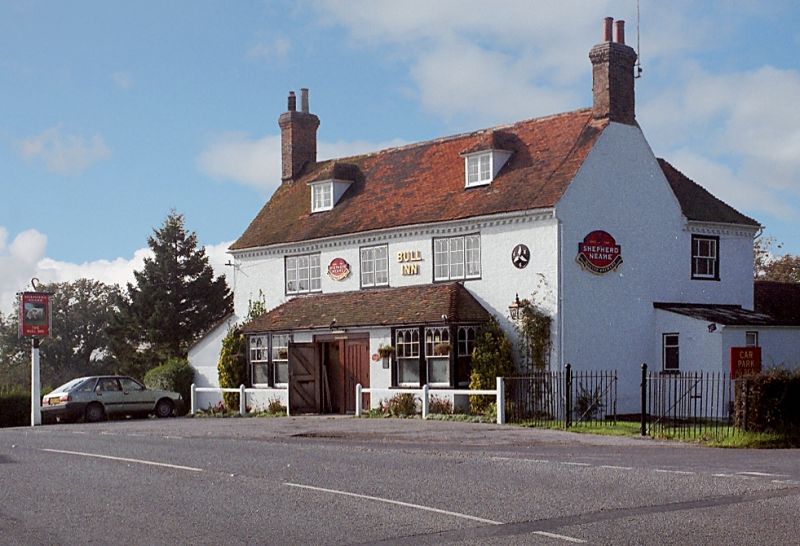
1.
5272 BETHERSDEN ASHFORD ROAD
The Bull Inn
TQ 9239 21/19
II
2.
C18. Two storeys and attics painted brick. Tiled roof with 2 hipped dormers.
Brick eaves cornice of modillions and cogging. Three casement windows with
pointed Gothick heads to the lights. Two large bays on the ground floor.
Double doorcase between with pediment missing.
Listing NGR: TQ9241239845
External links are from the relevant listing authority and, where applicable, Wikidata. Wikidata IDs may be related buildings as well as this specific building. If you want to add or update a link, you will need to do so by editing the Wikidata entry.


Other nearby listed buildings
