Approximate Location Map
Large Map »
Latitude: 51.0523 / 51°3'8"N
Longitude: 0.6298 / 0°37'47"E
OS Eastings: 584409
OS Northings: 131396
OS Grid: TQ844313
Mapcode National: GBR QW6.XQY
Mapcode Global: FRA D66B.P4H
Plus Code: 9F323J2H+WW
Entry Name: The Star Public House
Listing Date: 9 August 1979
Grade: II
Source: Historic England
Source ID: 1070920
English Heritage Legacy ID: 180337
Also known as: Star
The Star, Cranbrook
ID on this website: 101070920
Location: Rolvenden, Ashford, Kent, TN17
County: Kent
District: Ashford
Civil Parish: Rolvenden
Built-Up Area: Rolvenden
Traditional County: Kent
Lieutenancy Area (Ceremonial County): Kent
Tagged with: Pub
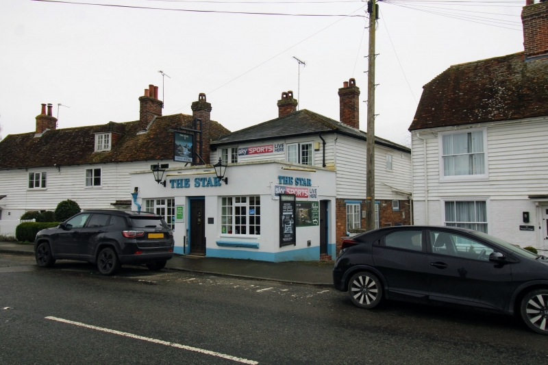
ROLVENDEN HIGH STREET
1.
5272 (west side)
No 30
(The Star Public House)
TQ 8431 18/293
II GV
2.
Mid C19. Two storeys weatherboarded. Hipped slate roof. Two casements.
Later bar front built out on ground floor. Included for group value.
Listing NGR: TQ8440331397
External links are from the relevant listing authority and, where applicable, Wikidata. Wikidata IDs may be related buildings as well as this specific building. If you want to add or update a link, you will need to do so by editing the Wikidata entry.


Other nearby listed buildings
