Approximate Location Map
Large Map »
Latitude: 51.0532 / 51°3'11"N
Longitude: 0.63 / 0°37'48"E
OS Eastings: 584424
OS Northings: 131494
OS Grid: TQ844314
Mapcode National: GBR QW6.XT6
Mapcode Global: FRA D66B.H8H
Plus Code: 9F323J3J+72
Entry Name: 45-55, High Street
Listing Date: 16 August 1962
Grade: II
Source: Historic England
Source ID: 1070927
English Heritage Legacy ID: 180355
ID on this website: 101070927
Location: Rolvenden, Ashford, Kent, TN17
County: Kent
District: Ashford
Civil Parish: Rolvenden
Built-Up Area: Rolvenden
Traditional County: Kent
Lieutenancy Area (Ceremonial County): Kent
Tagged with: Building
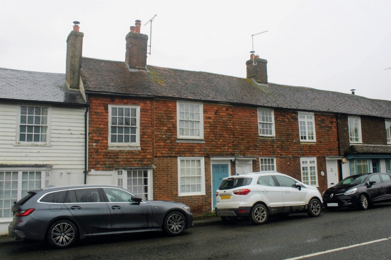
ROLVENDEN HIGH STREET
1.
5272 (east side)
Nos 45 to 55 (odd)
TQ 8431 18/311 16.8.62.
II GV
2.
Early C19 range. Two storeys. Ground floor red brick, painted to No 47.
First floor tile hung. Tiled roof. Seven sashes in all with glazing bars
intact. Doorcases with flat hoods and brackets. No 47 has a later shop front.
Listing NGR: TQ8442631482
External links are from the relevant listing authority and, where applicable, Wikidata. Wikidata IDs may be related buildings as well as this specific building. If you want to add or update a link, you will need to do so by editing the Wikidata entry.


Other nearby listed buildings
