Approximate Location Map
Large Map »
Latitude: 51.1038 / 51°6'13"N
Longitude: 0.7118 / 0°42'42"E
OS Eastings: 589948
OS Northings: 137326
OS Grid: TQ899373
Mapcode National: GBR QVR.LSZ
Mapcode Global: VHKKR.9J56
Plus Code: 9F324P36+GP
Entry Name: Hathewolden Grange
Listing Date: 16 August 1962
Grade: II
Source: Historic England
Source ID: 1070964
English Heritage Legacy ID: 180235
ID on this website: 101070964
Location: High Halden, Ashford, Kent, TN26
County: Kent
District: Ashford
Civil Parish: High Halden
Built-Up Area: High Halden
Traditional County: Kent
Lieutenancy Area (Ceremonial County): Kent
Tagged with: Building
HIGH HALDEN
1.
5272
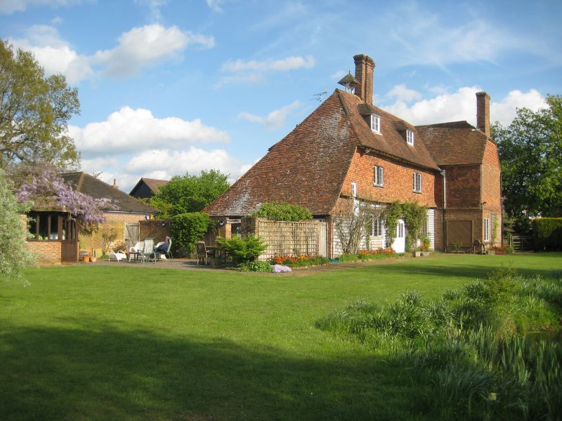
Hathewolden Grange
TQ 83 NE 4/182 16.8.62.
II
2.
L-shaped Cl7 or earlier building, refaced with red brick on the ground floor
and hung with fishscale tiles above, with a brick stringcourse and bellcast
between. Two storeys and attics. Half-hipped tiled roof. Wooden eaves cornice.
Casement windows with small square leaded panes. Three windows and three
dormers facing south, two windows and one hipped dormer facing west.
Listing NGR: TQ8994837326
External links are from the relevant listing authority and, where applicable, Wikidata. Wikidata IDs may be related buildings as well as this specific building. If you want to add or update a link, you will need to do so by editing the Wikidata entry.


Other nearby listed buildings
