Approximate Location Map
Large Map »
Latitude: 51.1284 / 51°7'42"N
Longitude: 0.6211 / 0°37'16"E
OS Eastings: 583504
OS Northings: 139841
OS Grid: TQ835398
Mapcode National: GBR QVF.1WC
Mapcode Global: VHJN1.QW7T
Plus Code: 9F324JHC+9F
Entry Name: Iraden
Listing Date: 9 August 1979
Grade: II
Source: Historic England
Source ID: 1071002
English Heritage Legacy ID: 180122
ID on this website: 101071002
Location: Hareplain, Ashford, Kent, TN27
County: Kent
District: Ashford
Civil Parish: Biddenden
Traditional County: Kent
Lieutenancy Area (Ceremonial County): Kent
Tagged with: Building
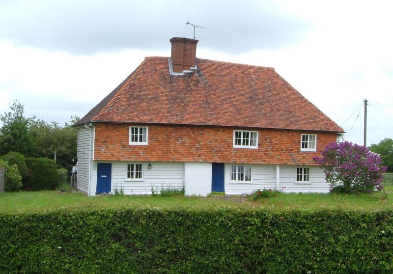
BIDDENDEN
1.
5272 Iraden
TQ 83 NW 3/105
II
2.
C16 or earlier. A timber-framed building refaced in the C18 with weatherboarding
on the ground floor and tile hung above but still preserving the overhang
of the 1st floor on brackets. Two storeys. Hipped tiled roof. Three casement
windows.
Listing NGR: TQ8512438259
External links are from the relevant listing authority and, where applicable, Wikidata. Wikidata IDs may be related buildings as well as this specific building. If you want to add or update a link, you will need to do so by editing the Wikidata entry.


Other nearby listed buildings
