Approximate Location Map
Large Map »
Latitude: 51.1504 / 51°9'1"N
Longitude: 0.8735 / 0°52'24"E
OS Eastings: 601064
OS Northings: 142940
OS Grid: TR010429
Mapcode National: GBR RWP.ZL7
Mapcode Global: VHKKN.3B4Y
Plus Code: 9F325V2F+5C
Entry Name: 28, North Street
Listing Date: 18 June 1971
Grade: II
Source: Historic England
Source ID: 1071039
English Heritage Legacy ID: 180016
ID on this website: 101071039
Location: St George's Square, Ashford, Kent, TN24
County: Kent
District: Ashford
Electoral Ward/Division: Victoria
Parish: Non Civil Parish
Built-Up Area: Ashford (Ashford)
Traditional County: Kent
Lieutenancy Area (Ceremonial County): Kent
Tagged with: Building
1.
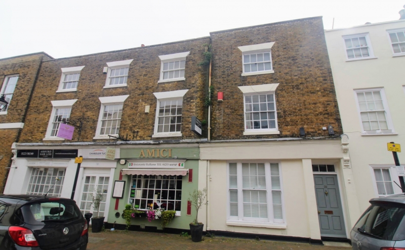
5344 NORTH STREET
(East Side)
No 28
TR 0142 NW 1/247 18.6.71.
II GV
2.
Early C19. 3 storeys yellow brick the ground floor stuccoed. Hipped tiled roof
and stone parapet. 1 sash with glazing bars intact. The ground floor has 1
tripartite sash and a simple doorcase with rectangular fanlight.
Nos 14 to 32 (even) form a group.
Listing NGR: TR0106442940
External links are from the relevant listing authority and, where applicable, Wikidata. Wikidata IDs may be related buildings as well as this specific building. If you want to add or update a link, you will need to do so by editing the Wikidata entry.


Other nearby listed buildings
