Approximate Location Map
Large Map »
Latitude: 51.138 / 51°8'16"N
Longitude: 0.6762 / 0°40'34"E
OS Eastings: 587320
OS Northings: 141047
OS Grid: TQ873410
Mapcode National: GBR QV9.PS4
Mapcode Global: VHJN2.NNVF
Plus Code: 9F324MQG+6F
Entry Name: Gillham
Listing Date: 10 October 1980
Grade: II
Source: Historic England
Source ID: 1071364
English Heritage Legacy ID: 181275
ID on this website: 101071364
Location: Tylden, Ashford, Kent, TN27
County: Kent
District: Ashford
Civil Parish: Smarden
Traditional County: Kent
Lieutenancy Area (Ceremonial County): Kent
Tagged with: Building
1.
5272 SMARDEN TILDEN
Gillham
TQ 8741 30/72
II
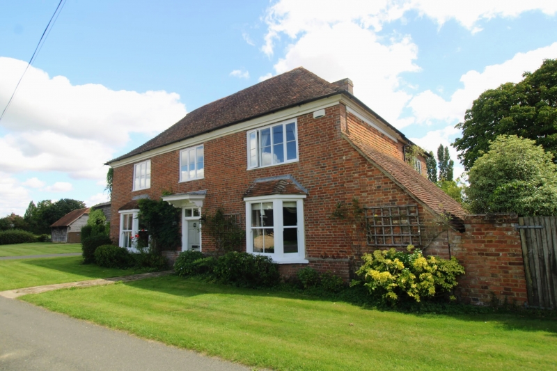
2.
C18. Two storeys red brick. Hipped tiled roof. Moulded wooden eaves cornice.
Three casement windows on first floor, two C19 bays on ground floor. Doorcase
between these with flat hood on brackets, rectangular fanlight and door of
6 fielded panels.
Listing NGR: TQ8732041047
External links are from the relevant listing authority and, where applicable, Wikidata. Wikidata IDs may be related buildings as well as this specific building. If you want to add or update a link, you will need to do so by editing the Wikidata entry.


Other nearby listed buildings
