Approximate Location Map
Large Map »
Latitude: 54.1405 / 54°8'25"N
Longitude: -2.6304 / 2°37'49"W
OS Eastings: 358912
OS Northings: 471812
OS Grid: SD589718
Mapcode National: GBR BN2K.BH
Mapcode Global: WH951.K6M5
Plus Code: 9C6V49R9+5R
Entry Name: Cross Base, Approximately 2 Metres South of Church of St John the Baptist
Listing Date: 4 December 1985
Grade: II
Source: Historic England
Source ID: 1071729
English Heritage Legacy ID: 182298
ID on this website: 101071729
Location: Arkholme Parish Church, Arkholme, Lancaster, Lancashire, LA6
County: Lancashire
District: Lancaster
Civil Parish: Arkholme-with-Cawood
Traditional County: Lancashire
Lieutenancy Area (Ceremonial County): Lancashire
Church of England Parish: Arkholme
Church of England Diocese: Blackburn
Tagged with: Churchyard cross
ARKHOLME-WITH-CAWOOD
SD 57 SE
4/4
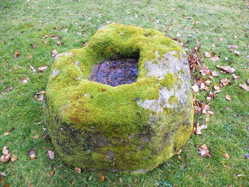
Cross base, approx. 2 metres south of Church of St John the Baptist
GV
II
Cross base, medieval. An irregular sandstone boulder with roughly-dressed
sides, with a square socket for a shaft.
Listing NGR: SD5891271812
External links are from the relevant listing authority and, where applicable, Wikidata. Wikidata IDs may be related buildings as well as this specific building. If you want to add or update a link, you will need to do so by editing the Wikidata entry.


Other nearby listed buildings
