Approximate Location Map
Large Map »
Latitude: 51.2584 / 51°15'30"N
Longitude: 0.2688 / 0°16'7"E
OS Eastings: 558408
OS Northings: 153467
OS Grid: TQ584534
Mapcode National: GBR MNF.2SC
Mapcode Global: VHHPT.LMZP
Plus Code: 9F327759+8G
Entry Name: Garden Urn 30 Yards West of Ightham Mote
Listing Date: 3 May 1984
Grade: II
Source: Historic England
Source ID: 1071971
English Heritage Legacy ID: 357260
ID on this website: 101071971
Location: Tonbridge and Malling, Kent, TN15
County: Kent
District: Tonbridge and Malling
Town: Tonbridge and Malling
Civil Parish: Ightham
Traditional County: Kent
Lieutenancy Area (Ceremonial County): Kent
Church of England Parish: Ightham St Peter
Church of England Diocese: Rochester
Tagged with: Building
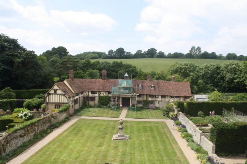
TQ 55 SE IGHTHAM MOTE ROAD
3/7 (east side)
Garden Urn 30 yds
west of Ightham Mote
II
Garden urn. Late C18. Stone. Classical panelled pedestal, 4 ft high. Thin-necked
vase about 4 ft high, with thick spiral fluting.
Listing NGR: TQ5847253484
External links are from the relevant listing authority and, where applicable, Wikidata. Wikidata IDs may be related buildings as well as this specific building. If you want to add or update a link, you will need to do so by editing the Wikidata entry.


Other nearby listed buildings
