Approximate Location Map
Large Map »
Latitude: 53.9668 / 53°58'0"N
Longitude: -2.4406 / 2°26'26"W
OS Eastings: 371191
OS Northings: 452387
OS Grid: SD711523
Mapcode National: GBR CQDK.DS
Mapcode Global: WH95X.HK1C
Plus Code: 9C5VXH85+PQ
Entry Name: 4, Chapel Street
Listing Date: 16 November 1983
Grade: II
Source: Historic England
Source ID: 1072215
English Heritage Legacy ID: 183125
ID on this website: 101072215
Location: Slaidburn, Ribble Valley, Lancashire, BB7
County: Lancashire
District: Ribble Valley
Civil Parish: Slaidburn
Traditional County: Yorkshire
Lieutenancy Area (Ceremonial County): Lancashire
Church of England Parish: Slaidburn St Andrew
Church of England Diocese: Leeds
Tagged with: Building
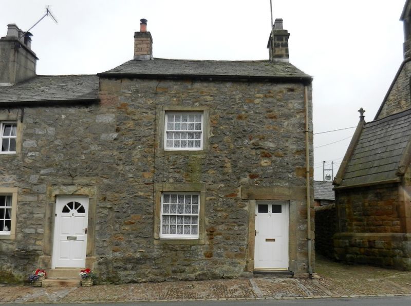
SD 7052-7152 SLAIDBURN CHAPEL STREET (SOUTH SIDE)
17/74 No. 4
-
GV II
House, part of a row, c,1800. Limestone and sandstone rubble with
sandstone dressings and slate roof. 2 storeys, one bay, with door to the
right. Windows and door have plain stone surrounds. Windows sashed with
glazing bars. End stacks.
Listing NGR: SD7119152387
External links are from the relevant listing authority and, where applicable, Wikidata. Wikidata IDs may be related buildings as well as this specific building. If you want to add or update a link, you will need to do so by editing the Wikidata entry.


Other nearby listed buildings
