Approximate Location Map
Large Map »
Latitude: 53.8853 / 53°53'7"N
Longitude: -2.7802 / 2°46'48"W
OS Eastings: 348814
OS Northings: 443518
OS Grid: SD488435
Mapcode National: GBR 9R0H.WZ
Mapcode Global: WH850.8LBT
Plus Code: 9C5VV6P9+4W
Entry Name: Milestone
Listing Date: 9 January 1986
Grade: II
Source: Historic England
Source ID: 1072869
English Heritage Legacy ID: 185516
ID on this website: 101072869
Location: Nook, Wyre, Lancashire, PR3
County: Lancashire
District: Wyre
Civil Parish: Kirkland
Built-Up Area: Catterall
Traditional County: Lancashire
Lieutenancy Area (Ceremonial County): Lancashire
Church of England Parish: Garstang St Helen, Churchtown
Church of England Diocese: Blackburn
Tagged with: Milestone
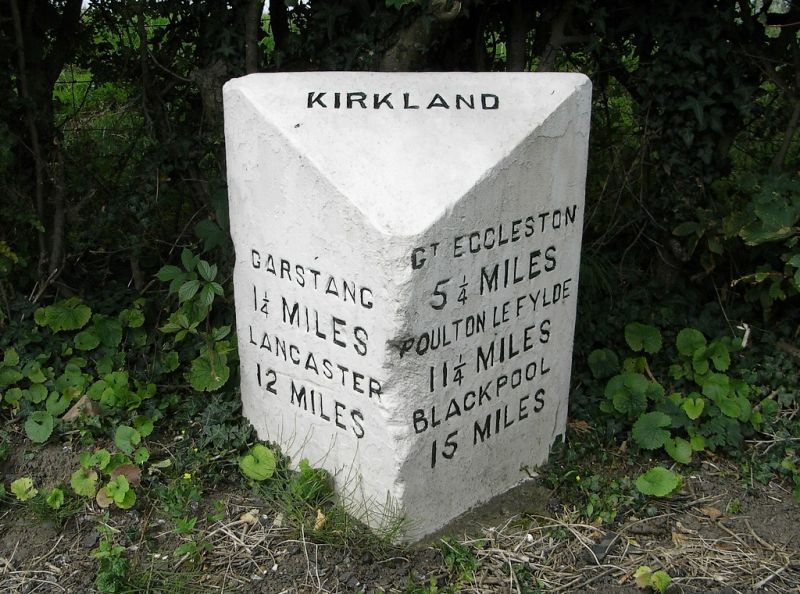
KIRKLAND A6
SD 44 SE
7/122 Milestone
-
- II
Milestone, C19, sandstone. Triangular plan with slopinq top inscribed:
'KIRKLAND'. Left-hand face inscribed: 'GARSTANG 1 1/4 MILES. LANCASTER 12
MILES.' Right-hand face inscribed: 'GT ECCLESTON 5 1/4 MILES. POULTON LE
FYLDE 11 1/4 MILES. BLACKPOOL 15 MILES.'
Listing NGR: SD4881443518
External links are from the relevant listing authority and, where applicable, Wikidata. Wikidata IDs may be related buildings as well as this specific building. If you want to add or update a link, you will need to do so by editing the Wikidata entry.


Other nearby listed buildings
