Approximate Location Map
Large Map »
Latitude: 53.932 / 53°55'55"N
Longitude: -2.1691 / 2°10'8"W
OS Eastings: 388992
OS Northings: 448442
OS Grid: SD889484
Mapcode National: GBR FQ9Z.57
Mapcode Global: WHB7C.NF9J
Plus Code: 9C5VWRJJ+Q8
Entry Name: Leeds and Liverpool Canal Lock Number 42
Listing Date: 29 January 1988
Grade: II
Source: Historic England
Source ID: 1073424
English Heritage Legacy ID: 186149
ID on this website: 101073424
Location: Pendle, Lancashire, BD23
County: Lancashire
District: Pendle
Civil Parish: Barnoldswick
Built-Up Area: Barnoldswick
Traditional County: Yorkshire
Lieutenancy Area (Ceremonial County): Lancashire
Tagged with: Lock
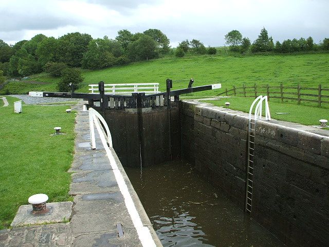
SD 84 NE BARNOLDSWICK LEEDS AND LIVERPOOL CANAL,
Greenberfield Locks
3/290
Lock No 42
-
GV II
Lock, 1817. Ashlar with wooden gates (upper pair restored 1981). Two retaining
walls of large punched blocks curving outwards at each end with ramped coping at
lower end.
Listing NGR: SD8899248442
External links are from the relevant listing authority and, where applicable, Wikidata. Wikidata IDs may be related buildings as well as this specific building. If you want to add or update a link, you will need to do so by editing the Wikidata entry.


Other nearby listed buildings
