Approximate Location Map
Large Map »
Latitude: 53.8543 / 53°51'15"N
Longitude: -2.2105 / 2°12'37"W
OS Eastings: 386252
OS Northings: 439806
OS Grid: SD862398
Mapcode National: GBR FR0W.72
Mapcode Global: WHB7R.0DP2
Plus Code: 9C5VVQ3Q+PR
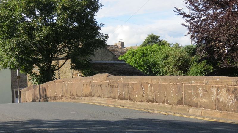
Entry Name: Barrowford Bridge
Listing Date: 23 June 1968
Grade: II
Source: Historic England
Source ID: 1073430
English Heritage Legacy ID: 186166
ID on this website: 101073430
Location: Barrowford, Pendle, Lancashire, BB9
County: Lancashire
District: Pendle
Civil Parish: Barrowford
Built-Up Area: Barrowford
Traditional County: Lancashire
Lieutenancy Area (Ceremonial County): Lancashire
Church of England Parish: Barrowford St Thomas
Church of England Diocese: Blackburn
Tagged with: Bridge
SD 8639 NW BARROWFORD COLNE ROAD
16/33 Barrowford Bridge
23.6.68
GV II
Road bridge. Early C19. Stone. 2 segmental arches with voussoirs. Plain parapet.
Listing NGR: SD8625239806
External links are from the relevant listing authority and, where applicable, Wikidata. Wikidata IDs may be related buildings as well as this specific building. If you want to add or update a link, you will need to do so by editing the Wikidata entry.


Other nearby listed buildings
