Approximate Location Map
Large Map »
Latitude: 52.8057 / 52°48'20"N
Longitude: -1.1076 / 1°6'27"W
OS Eastings: 460255
OS Northings: 323496
OS Grid: SK602234
Mapcode National: GBR 9LW.2SN
Mapcode Global: WHDHK.YQRZ
Plus Code: 9C4WRV4R+7X
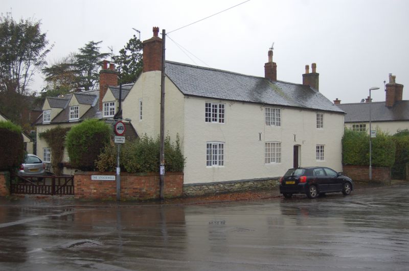
Entry Name: 52, Far Street
Listing Date: 15 March 1984
Grade: II
Source: Historic England
Source ID: 1074541
English Heritage Legacy ID: 189363
ID on this website: 101074541
Location: Wymeswold, Charnwood, Leicestershire, LE12
County: Leicestershire
District: Charnwood
Civil Parish: Wymeswold
Built-Up Area: Wymeswold
Traditional County: Leicestershire
Lieutenancy Area (Ceremonial County): Leicestershire
Church of England Parish: Wymeswold St Mary
Church of England Diocese: Leicester
Tagged with: Building
SK 6023 - 6123 WYMESWOLD FAR STREET
South side
2/105 No. 52
GV II
House, probably mid C18. Rendered brickwork on rubble plinth. 2 storeys,
3 unit plan, with gable stacks, and an axial stack backing on to entry.
Windows are horizontal sliding sashes, 2 of which have cambered heads.
Listing NGR: SK6025523496
External links are from the relevant listing authority and, where applicable, Wikidata. Wikidata IDs may be related buildings as well as this specific building. If you want to add or update a link, you will need to do so by editing the Wikidata entry.


Other nearby listed buildings
