Approximate Location Map
Large Map »
Latitude: 52.3695 / 52°22'10"N
Longitude: -1.6983 / 1°41'53"W
OS Eastings: 420639
OS Northings: 274644
OS Grid: SP206746
Mapcode National: GBR 4JP.HFC
Mapcode Global: VHBX1.JP1Y
Plus Code: 9C4W9892+QM
Entry Name: Manor Farmhouse
Listing Date: 22 July 1976
Grade: II
Source: Historic England
Source ID: 1075981
English Heritage Legacy ID: 218005
ID on this website: 101075981
Location: Solihull, West Midlands, B93
County: Solihull
Civil Parish: Chadwick End
Traditional County: Warwickshire
Lieutenancy Area (Ceremonial County): West Midlands
Church of England Parish: Temple Balsall
Church of England Diocese: Birmingham
Tagged with: Farmhouse
BALSALL BARSTON LANE
1.
5108
(East Side)
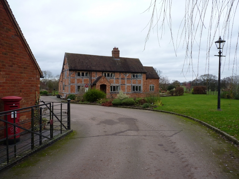
SP 27 SW 13/109 Manor Farmhouse
II
2.
Oldwick Farm on Ordnance Survey sheet. C17 timber frame, whitewashed brick nogging
and front wall, tiled roof. 2 storeys, 4 flush casement windows with glazing bars.
Rea brick chimney stack with base and cap bands. Lean-to at back.
Listing NGR: SP2063974644
External links are from the relevant listing authority and, where applicable, Wikidata. Wikidata IDs may be related buildings as well as this specific building. If you want to add or update a link, you will need to do so by editing the Wikidata entry.


Other nearby listed buildings
