Approximate Location Map
Large Map »
Latitude: 52.4117 / 52°24'42"N
Longitude: -1.7767 / 1°46'36"W
OS Eastings: 415285
OS Northings: 279325
OS Grid: SP152793
Mapcode National: GBR 4J0.TXD
Mapcode Global: VH9ZC.5N21
Plus Code: 9C4WC66F+M8
Entry Name: 6, the Square
Listing Date: 5 December 1949
Grade: II
Source: Historic England
Source ID: 1076695
English Heritage Legacy ID: 218306
ID on this website: 101076695
Location: Solihull, West Midlands, B91
County: Solihull
Electoral Ward/Division: St Alphege
Parish: Non Civil Parish
Built-Up Area: Solihull
Traditional County: Warwickshire
Lieutenancy Area (Ceremonial County): West Midlands
Church of England Parish: Solihull
Church of England Diocese: Birmingham
Tagged with: Building
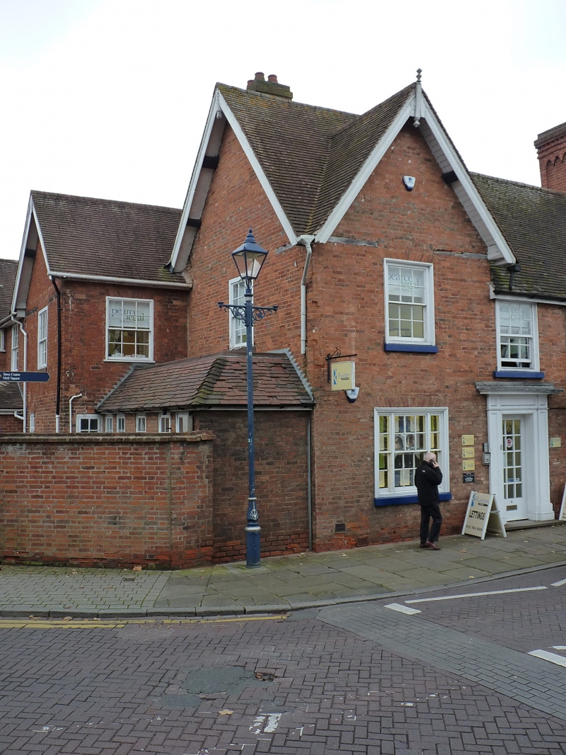
SOLIHULL THE SQUARE
1.
5108
(West Side)
No 6
SP 1579 1/465 5.12.49.
II GV
2.
C16 or C17, much rebuilt C18. Red brick, some timber framework, tiled roof. 2 storeys
sash windows. Gable on left. Doorway has Doric pilasters, entablature, cornice
hood.
Nos 2 to 6 (even) and No 158 Solihull High Street form a group.
Listing NGR: SP1528279326
External links are from the relevant listing authority and, where applicable, Wikidata. Wikidata IDs may be related buildings as well as this specific building. If you want to add or update a link, you will need to do so by editing the Wikidata entry.


Other nearby listed buildings
