Approximate Location Map
Large Map »
Latitude: 52.3878 / 52°23'15"N
Longitude: -1.7339 / 1°44'1"W
OS Eastings: 418208
OS Northings: 276669
OS Grid: SP182766
Mapcode National: GBR 4JG.6GR
Mapcode Global: VH9ZK.W7QW
Plus Code: 9C4W97Q8+4F
Entry Name: 1678 and 1680, Warwick Road
Listing Date: 22 July 1976
Grade: II
Source: Historic England
Source ID: 1076706
English Heritage Legacy ID: 218335
ID on this website: 101076706
Location: Knowle, Solihull, West Midlands, B93
County: Solihull
Electoral Ward/Division: Knowle
Parish: Non Civil Parish
Built-Up Area: Solihull
Traditional County: Warwickshire
Lieutenancy Area (Ceremonial County): West Midlands
Church of England Parish: Knowle
Church of England Diocese: Birmingham
Tagged with: Building
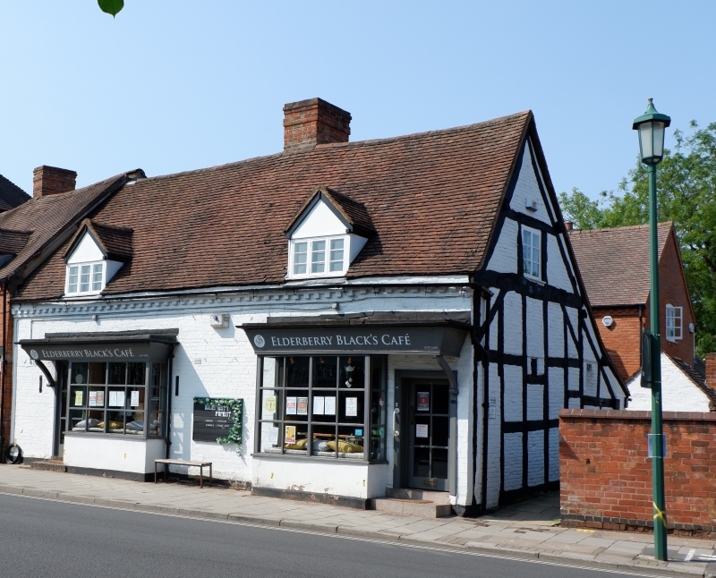
SOLIHULL KNOWLE
1.
5108
(High Street)
WARWICK ROAD
(South-West Side)
Nos 1678 & 1680
SP 1876 20/52
II GV
2.
C17. Gable on right has heavy square timber frame with diagonal bracing. Old tiled
roofs, 2 gabled dormers to red brick 1 storey and attic wing on left. Modern shop
fronts.
No 1672 and Nos 1678 to 1688 (even) form a group.
Listing NGR: SP1820676673
External links are from the relevant listing authority and, where applicable, Wikidata. Wikidata IDs may be related buildings as well as this specific building. If you want to add or update a link, you will need to do so by editing the Wikidata entry.


Other nearby listed buildings
