Approximate Location Map
Large Map »
Latitude: 52.6035 / 52°36'12"N
Longitude: 0.3681 / 0°22'5"E
OS Eastings: 560464
OS Northings: 303272
OS Grid: TF604032
Mapcode National: GBR N5F.PWB
Mapcode Global: WHJPS.MTHF
Plus Code: 9F42J939+C6
Entry Name: Laburnum House
Listing Date: 16 November 1972
Grade: II
Source: Historic England
Source ID: 1077202
English Heritage Legacy ID: 221168
ID on this website: 101077202
Location: Downham Market, King's Lynn and West Norfolk, Norfolk, PE38
County: Norfolk
District: King's Lynn and West Norfolk
Civil Parish: Downham Market
Built-Up Area: Downham Market
Traditional County: Norfolk
Lieutenancy Area (Ceremonial County): Norfolk
Church of England Parish: Downham Market
Church of England Diocese: Ely
Tagged with: House
RAILWAY ROAD
1. (North Side)
1051
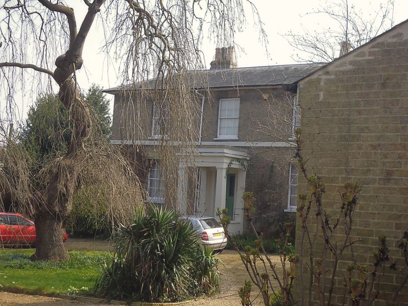
Laburnum House
TF 6O SW 1/95
II
2.
Circa 1820-30. 2 storey, buff brick. Slate roof, hipped. Wide eaves soffit.
3 sash Windows with glazing bars and gauged flat arches. 1st floor band.
Entrance door with glazed upper half, and Doric pedimented porch, stone steps.
Lawned garden.
Listing NGR: TF6046403272
External links are from the relevant listing authority and, where applicable, Wikidata. Wikidata IDs may be related buildings as well as this specific building. If you want to add or update a link, you will need to do so by editing the Wikidata entry.


Other nearby listed buildings
