Approximate Location Map
Large Map »
Latitude: 51.6209 / 51°37'15"N
Longitude: -0.317 / 0°19'1"W
OS Eastings: 516610
OS Northings: 192684
OS Grid: TQ166926
Mapcode National: GBR 6V.GRS
Mapcode Global: VHGQ9.GJ98
Plus Code: 9C3XJMCM+96
Entry Name: Pinnacle Place
Listing Date: 13 October 1975
Grade: II
Source: Historic England
Source ID: 1079719
English Heritage Legacy ID: 202045
ID on this website: 101079719
Location: Stanmore, Harrow, London, HA7
County: London
District: Harrow
Electoral Ward/Division: Stanmore Park
Parish: Non Civil Parish
Built-Up Area: Harrow
Traditional County: Middlesex
Lieutenancy Area (Ceremonial County): Greater London
Church of England Parish: St John the Evangelist Great Stanmore
Church of England Diocese: London
Tagged with: Building
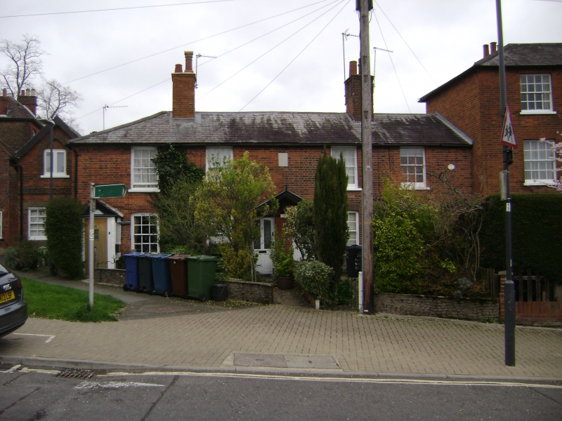
GREEN LANE
1.
5016
Stanmore
Pinnacle Place
[Nos 1 to 4 (consec)]
TQ 1692 NE 7/8 13.10.75
II GV
2.
Dated 1822. Two-storeys, 5 windows, those on ground floor with segmental heads.
Porches to doors, those of Nos 2 and 3 under a single broad porch. Slate roof.
Listing NGR: TQ1661192684
External links are from the relevant listing authority and, where applicable, Wikidata. Wikidata IDs may be related buildings as well as this specific building. If you want to add or update a link, you will need to do so by editing the Wikidata entry.


Other nearby listed buildings
