Approximate Location Map
Large Map »
Latitude: 52.2052 / 52°12'18"N
Longitude: -2.1148 / 2°6'53"W
OS Eastings: 392250
OS Northings: 256335
OS Grid: SO922563
Mapcode National: GBR 2HF.L55
Mapcode Global: VH92P.9TBW
Plus Code: 9C4V6V4P+33
Entry Name: The Barn
Listing Date: 23 November 1973
Grade: II
Source: Historic England
Source ID: 1081269
English Heritage Legacy ID: 147679
ID on this website: 101081269
Location: Crowle Green, Wychavon, Worcestershire, WR7
County: Worcestershire
District: Wychavon
Civil Parish: Crowle
Built-Up Area: Crowle
Traditional County: Worcestershire
Lieutenancy Area (Ceremonial County): Worcestershire
Church of England Parish: Crowle with Bredicot
Church of England Diocese: Worcester
Tagged with: Barn
This list entry was subject to a Minor Amendment on 1 April 2022 to update the name and address and to reformat the text to current standards
SO 95 NW
6/3
CROWLE CP
CHURCH ROAD
Old House Farm
The Barn
(Formerly listed as CHURCH ROAD (west side) Barn about 30 yards north of Old House Farm)
23.11.73
GV
II
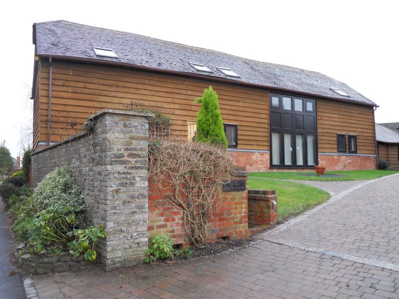
Barn. Late C18. Timber-framed on tall brick plinth, weatherboarded with half-hipped, mid-C20 plain tiled roof. Four framed bays aligned east/west with wagon bay second from west gable end having opposed square-headed cart entries with double doors. Plinth at east gable end has three raking buttresses; south elevation has large metal-framed multi-paned window with a cambered head in the left end bay; there are two rectangular lights in the west gable end.
Interior: framing of long rectangular panels from sill to wall-plate, collar and tie-beam trusses with two struts and angled struts from main strut base to principal rafters; two tiers of trenched purlins and board ridge. West end bay is floored.
A single-bay stable addition adjoins the west gable end, part brick with some weatherboarded timber-framing and a hipped tile roof; in the south front elevation is a stable door and wood-mullioned window with blue brick sill.
Listing NGR: SO9225056335
External links are from the relevant listing authority and, where applicable, Wikidata. Wikidata IDs may be related buildings as well as this specific building. If you want to add or update a link, you will need to do so by editing the Wikidata entry.


Other nearby listed buildings
