Approximate Location Map
Large Map »
Latitude: 54.0016 / 54°0'5"N
Longitude: -0.4327 / 0°25'57"W
OS Eastings: 502829
OS Northings: 457307
OS Grid: TA028573
Mapcode National: GBR TQF5.39
Mapcode Global: WHGDC.BP66
Plus Code: 9C6X2H28+JW
Entry Name: Crane Approximately 60 Metres East of Number 5
Listing Date: 25 January 1985
Grade: II
Source: Historic England
Source ID: 1083382
English Heritage Legacy ID: 166887
ID on this website: 101083382
Location: Driffield, East Riding of Yorkshire, YO25
County: East Riding of Yorkshire
Civil Parish: Driffield
Built-Up Area: Driffield
Traditional County: Yorkshire
Lieutenancy Area (Ceremonial County): East Riding of Yorkshire
Church of England Parish: Great Driffield All Saints
Church of England Diocese: York
Tagged with: Building
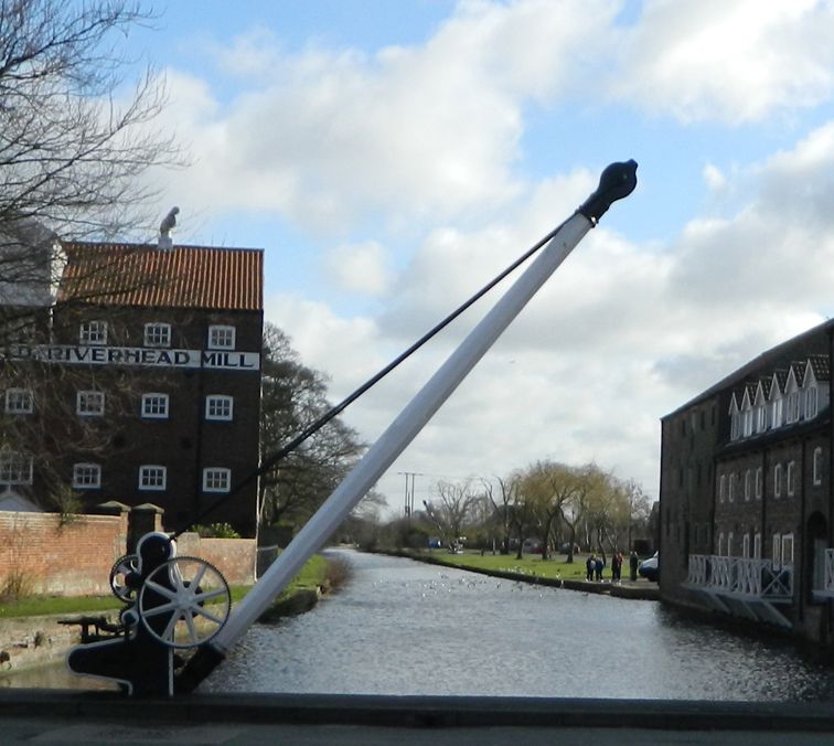
TA 02 57 DRIFFIELD RIVER HEAD
(south side)
14/28 Crane approximately
60 metres east of No 5
GV II
Hand-operated swivel crane. C19. Wrought-iron stays, timber jib, cast-iron
frame and machinery.
Listing NGR: TA0282957307
External links are from the relevant listing authority and, where applicable, Wikidata. Wikidata IDs may be related buildings as well as this specific building. If you want to add or update a link, you will need to do so by editing the Wikidata entry.


Other nearby listed buildings
