Approximate Location Map
Large Map »
Latitude: 53.8419 / 53°50'30"N
Longitude: -0.4293 / 0°25'45"W
OS Eastings: 503447
OS Northings: 439550
OS Grid: TA034395
Mapcode National: GBR TSF0.VJ
Mapcode Global: WHGF4.CPTL
Plus Code: 9C5XRHRC+Q7
Entry Name: 51, 53, Toll Gavel
Listing Date: 31 January 1975
Grade: II
Source: Historic England
Source ID: 1083943
English Heritage Legacy ID: 167480
ID on this website: 101083943
Location: Beverley, East Riding of Yorkshire, HU17
County: East Riding of Yorkshire
Civil Parish: Beverley
Built-Up Area: Beverley
Traditional County: Yorkshire
Lieutenancy Area (Ceremonial County): East Riding of Yorkshire
Church of England Parish: Beverley St Mary
Church of England Diocese: York
Tagged with: Building
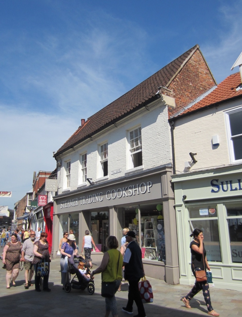
BEVERLEY TOLL GAVEL
TA 0339 (east side)
9/353 Nos 51 and 53
31.1.75
GV II
Mid C18. Two storeys in painted brick with pantiled roof and tumbled brickwork
to gable ends. Four windows, painted stone heads and cills. Dentil eaves
cornice. Modern shop front.
Listing NGR: TA0344739550
External links are from the relevant listing authority and, where applicable, Wikidata. Wikidata IDs may be related buildings as well as this specific building. If you want to add or update a link, you will need to do so by editing the Wikidata entry.


Other nearby listed buildings
