Approximate Location Map
Large Map »
Latitude: 51.3613 / 51°21'40"N
Longitude: 1.0236 / 1°1'24"E
OS Eastings: 610592
OS Northings: 166815
OS Grid: TR105668
Mapcode National: GBR TX1.MLP
Mapcode Global: VHKJR.P1HQ
Plus Code: 9F33926F+GC
Entry Name: Beach Cottage
Listing Date: 20 May 1977
Grade: II
Source: Historic England
Source ID: 1084914
English Heritage Legacy ID: 170870
ID on this website: 101084914
Location: Whitstable, Canterbury, Kent, CT5
County: Kent
District: Canterbury
Electoral Ward/Division: Gorrell
Parish: Non Civil Parish
Built-Up Area: Whitstable
Traditional County: Kent
Lieutenancy Area (Ceremonial County): Kent
Tagged with: Cottage
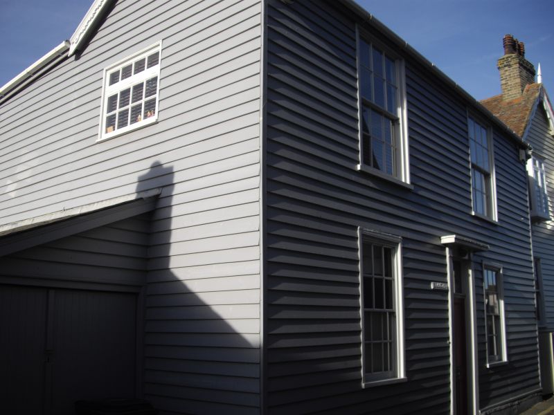
SEA WALL
1.
5273
(North-West Side)
Beach Cottage
TR 1066 NE 1/190
II GV
2.
Early C19 2 storey building. Roughcast. Felted roof. 2 box sash windows 1st
floor and 2 ground floor, original glazing in 3 window. Door with pilasters and
entablature around.
Listing NGR: TR1059266815
External links are from the relevant listing authority and, where applicable, Wikidata. Wikidata IDs may be related buildings as well as this specific building. If you want to add or update a link, you will need to do so by editing the Wikidata entry.


Other nearby listed buildings
