Approximate Location Map
Large Map »
Latitude: 51.3538 / 51°21'13"N
Longitude: 1.0256 / 1°1'32"E
OS Eastings: 610769
OS Northings: 165978
OS Grid: TR107659
Mapcode National: GBR TX7.23N
Mapcode Global: VHKJR.Q7KJ
Plus Code: 9F33923G+G7
Entry Name: 27 and 29, Canterbury Road
Listing Date: 23 December 1975
Grade: II
Source: Historic England
Source ID: 1084970
English Heritage Legacy ID: 170801
ID on this website: 101084970
Location: Whitstable, Canterbury, Kent, CT5
County: Kent
District: Canterbury
Electoral Ward/Division: Gorrell
Parish: Non Civil Parish
Built-Up Area: Whitstable
Traditional County: Kent
Lieutenancy Area (Ceremonial County): Kent
Tagged with: Building
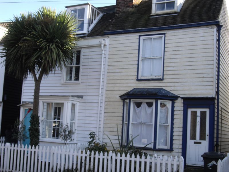
CANTERBURY ROAD
1.
5273
(South-East Side)
Nos 27 and 29
TR 16 NW 4/20B 25.12.75.
II GV
2.
Circa 1830-40 pair of detached timber framed cottages. No 27 weatherboarded and
No 29 pebbledashed. 2 storeys and attic part slate and part tiled roofs. Windows
altered; each cottage has bay window ground floor.
Listing NGR: TR1076965978
External links are from the relevant listing authority and, where applicable, Wikidata. Wikidata IDs may be related buildings as well as this specific building. If you want to add or update a link, you will need to do so by editing the Wikidata entry.


Other nearby listed buildings
