Approximate Location Map
Large Map »
Latitude: 51.2794 / 51°16'45"N
Longitude: 1.0797 / 1°4'46"E
OS Eastings: 614877
OS Northings: 157863
OS Grid: TR148578
Mapcode National: GBR TY2.PRV
Mapcode Global: VHLGM.N3MK
Plus Code: 9F3373HH+PV
Entry Name: 12 and 13, High Street
Listing Date: 3 May 1967
Grade: II
Source: Historic England
Source ID: 1085025
English Heritage Legacy ID: 170640
ID on this website: 101085025
Location: Canterbury, Kent, CT1
County: Kent
District: Canterbury
Electoral Ward/Division: Westgate
Parish: Non Civil Parish
Built-Up Area: Canterbury
Traditional County: Kent
Lieutenancy Area (Ceremonial County): Kent
Tagged with: Building
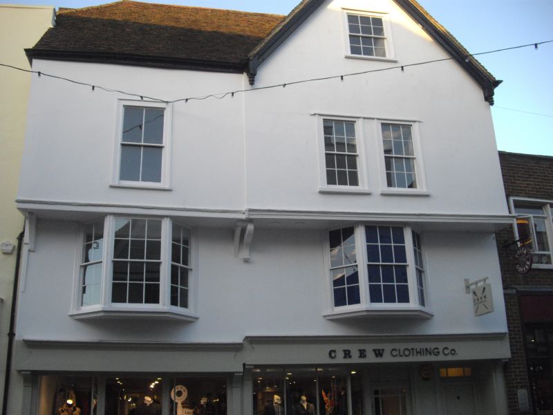
1.
944 HIGH STREET
(North East Side)
Nos 12 & 13
TR 1457 NE 4/63 3.5.67.
II GV
2.
Probably built as one house. A C16 timber-framed house restored. Plastered
front with imitation timbering added. 3 storeys. Old tiled roof. No 12
has a gable. 2 windows. 2nd floor overhangs on curved brackets.
Nos 11 to 15 (consec) form a group.
Listing NGR: TR1488457868
External links are from the relevant listing authority and, where applicable, Wikidata. Wikidata IDs may be related buildings as well as this specific building. If you want to add or update a link, you will need to do so by editing the Wikidata entry.


Other nearby listed buildings
