Approximate Location Map
Large Map »
Latitude: 51.2782 / 51°16'41"N
Longitude: 1.0846 / 1°5'4"E
OS Eastings: 615226
OS Northings: 157746
OS Grid: TR152577
Mapcode National: GBR TY2.YTY
Mapcode Global: VHLGM.R47G
Plus Code: 9F3373HM+7R
Entry Name: 3 and 4, Burgate
Listing Date: 7 September 1973
Grade: II
Source: Historic England
Source ID: 1085111
English Heritage Legacy ID: 170443
ID on this website: 101085111
Location: Canterbury, Kent, CT1
County: Kent
District: Canterbury
Electoral Ward/Division: Westgate
Parish: Non Civil Parish
Built-Up Area: Canterbury
Traditional County: Kent
Lieutenancy Area (Ceremonial County): Kent
Tagged with: Building
1.
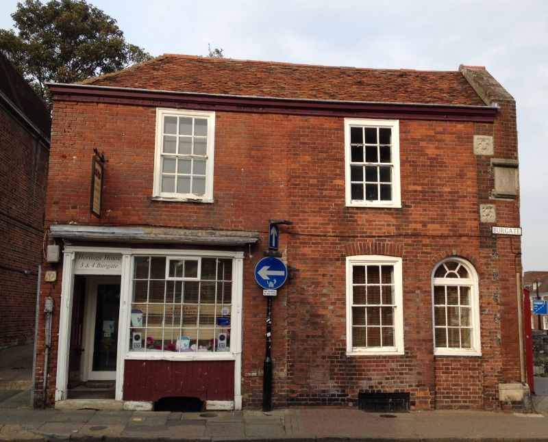
944 BURGATE
(North East Side)
Nos 3 and 4
TR 1557 NW 5/250
II
2.
C18. 2 parallel ranges, 2 storeys and basement red brick. Old tiled roof
with stone cornice. Sash windows with glazing bars. No 3 has had its doorcase
built out. No 4 has a fine early C19 bow shopfront. The house incorporates
masonry from the Mediaeval Burgate which stood on this site. The side and
rear elevations are tile-hung on the first floor.
Listing NGR: TR1522857747
External links are from the relevant listing authority and, where applicable, Wikidata. Wikidata IDs may be related buildings as well as this specific building. If you want to add or update a link, you will need to do so by editing the Wikidata entry.


Other nearby listed buildings
