Approximate Location Map
Large Map »
Latitude: 51.2785 / 51°16'42"N
Longitude: 1.083 / 1°4'58"E
OS Eastings: 615117
OS Northings: 157773
OS Grid: TR151577
Mapcode National: GBR TY2.YCN
Mapcode Global: VHLGM.Q4F8
Plus Code: 9F3373HM+96
Entry Name: Remains of St Mary Magdalen's Church Tower
Listing Date: 3 December 1949
Grade: II
Source: Historic England
Source ID: 1085123
English Heritage Legacy ID: 170469
ID on this website: 101085123
Location: Canterbury, Kent, CT1
County: Kent
District: Canterbury
Electoral Ward/Division: Westgate
Parish: Non Civil Parish
Built-Up Area: Canterbury
Traditional County: Kent
Lieutenancy Area (Ceremonial County): Kent
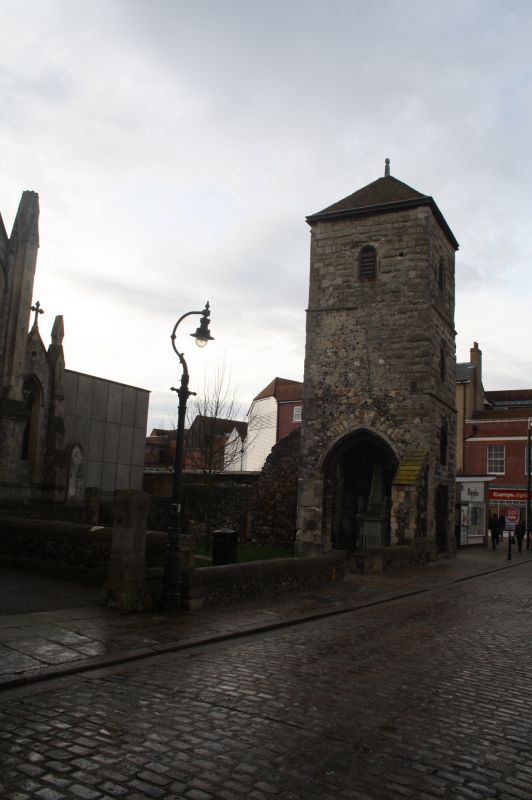
1.
944 BURGATE
(South West Side)
Tower. Remains of
St Mary Magdalen's Church
TR 1557 NW 5/29 3.12.49.
II
2.
All that remains of St Mary Magdalen's Church. 1503. The front elevation
is stone faced, the side is of flint and rubble. 4 storeys having lancets
with foliated heads. First floor has a double lancer. Ground floor has a
doorcase with decorated spandrels. Cl7 memorials. A scheduled AM.
Listing NGR: TR1511757773
External links are from the relevant listing authority and, where applicable, Wikidata. Wikidata IDs may be related buildings as well as this specific building. If you want to add or update a link, you will need to do so by editing the Wikidata entry.


Other nearby listed buildings
