Approximate Location Map
Large Map »
Latitude: 51.278 / 51°16'40"N
Longitude: 1.0843 / 1°5'3"E
OS Eastings: 615206
OS Northings: 157728
OS Grid: TR152577
Mapcode National: GBR TY2.YRF
Mapcode Global: VHLGM.R42L
Plus Code: 9F3373HM+6P
Entry Name: 1, Burgate Lane
Listing Date: 7 September 1973
Grade: II
Source: Historic England
Source ID: 1085126
English Heritage Legacy ID: 170477
ID on this website: 101085126
Location: Canterbury, Kent, CT1
County: Kent
District: Canterbury
Electoral Ward/Division: Westgate
Parish: Non Civil Parish
Built-Up Area: Canterbury
Traditional County: Kent
Lieutenancy Area (Ceremonial County): Kent
Tagged with: Building
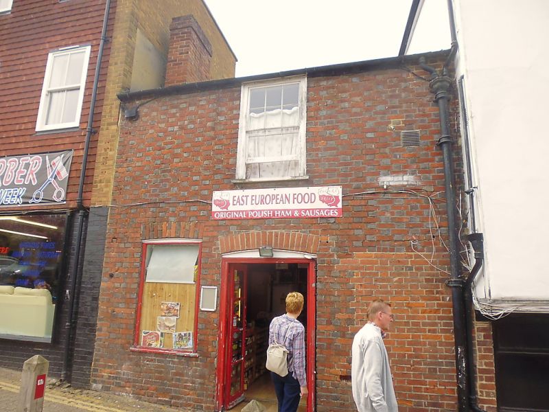
1.
944 BURGATE LANE
(North West Side)
No 1
TR 1557 NW 5/36
II GV
2.
Later C18. 2 storeys red brick. Old tiled roof, 1 sash in wooden surround
with glazing bars intact. Ground floor has a door with cambered arch.
Forms a group with Nos 62 to 69 (consec) Burgate.
Listing NGR: TR1520557728
External links are from the relevant listing authority and, where applicable, Wikidata. Wikidata IDs may be related buildings as well as this specific building. If you want to add or update a link, you will need to do so by editing the Wikidata entry.


Other nearby listed buildings
