Approximate Location Map
Large Map »
Latitude: 51.2816 / 51°16'53"N
Longitude: 1.08 / 1°4'48"E
OS Eastings: 614892
OS Northings: 158111
OS Grid: TR148581
Mapcode National: GBR TY2.PVC
Mapcode Global: VHLGM.N1TV
Plus Code: 9F3373JJ+J2
Entry Name: 31-35, Blackfriars Street
Listing Date: 7 September 1973
Grade: II
Source: Historic England
Source ID: 1085133
English Heritage Legacy ID: 170395
ID on this website: 101085133
Location: Canterbury, Kent, CT1
County: Kent
District: Canterbury
Electoral Ward/Division: Westgate
Parish: Non Civil Parish
Built-Up Area: Canterbury
Traditional County: Kent
Lieutenancy Area (Ceremonial County): Kent
Tagged with: Building
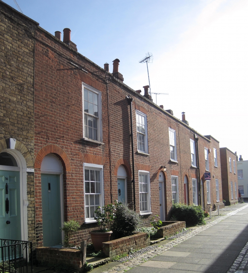
1.
944 BLACKFRIARS STREET
(East Side)
Nos 31 to 35 (consec)
TR 1458 SE 2/415
II GV
2.
MId C19. 2 storeys red brick. Slate roof with stone coping. 5 sashed set
in moulded architraves with glazing bars intact. Simple round-headed doorcases
with 4 panelled doors.
Nos 31 to 35 (consec) form a grade II group.
Listing NGR: TR1489258104
External links are from the relevant listing authority and, where applicable, Wikidata. Wikidata IDs may be related buildings as well as this specific building. If you want to add or update a link, you will need to do so by editing the Wikidata entry.


Other nearby listed buildings
