Approximate Location Map
Large Map »
Latitude: 51.3063 / 51°18'22"N
Longitude: 1.1476 / 1°8'51"E
OS Eastings: 619489
OS Northings: 161056
OS Grid: TR194610
Mapcode National: GBR TXZ.2YV
Mapcode Global: VHLGG.VF2G
Plus Code: 9F33844X+G3
Entry Name: Stable at East of Walnut Tree Farmhouse
Listing Date: 14 March 1980
Grade: II
Source: Historic England
Source ID: 1085484
English Heritage Legacy ID: 171530
ID on this website: 101085484
Location: Westbere, Canterbury, Kent, CT2
County: Kent
District: Canterbury
Town: Canterbury
Civil Parish: Westbere
Built-Up Area: Sturry
Traditional County: Kent
Lieutenancy Area (Ceremonial County): Kent
Tagged with: Stable
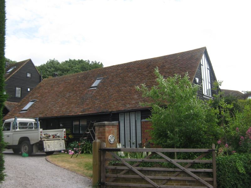
1.
5273 WESTBERE WALNUT TREE LANE
Stable at east of
Walnut Tree Farmhouse
TR 1961 33/659B
II GV
2.
Early C19. One storey. Part weatherboarded part painted brick. Tiled roof
gable ended.
Listing NGR: TR1948961056
External links are from the relevant listing authority and, where applicable, Wikidata. Wikidata IDs may be related buildings as well as this specific building. If you want to add or update a link, you will need to do so by editing the Wikidata entry.


Other nearby listed buildings
