Approximate Location Map
Large Map »
Latitude: 51.2733 / 51°16'23"N
Longitude: 0.5235 / 0°31'24"E
OS Eastings: 576120
OS Northings: 155704
OS Grid: TQ761557
Mapcode National: GBR PR7.163
Mapcode Global: VHJMF.1838
Plus Code: 9F327GFF+8C
Entry Name: 20, Gabriel's Hill
Listing Date: 2 August 1974
Grade: II
Source: Historic England
Source ID: 1086345
English Heritage Legacy ID: 173329
ID on this website: 101086345
Location: Maidstone, Kent, ME15
County: Kent
District: Maidstone
Electoral Ward/Division: High Street
Parish: Non Civil Parish
Built-Up Area: Maidstone
Traditional County: Kent
Lieutenancy Area (Ceremonial County): Kent
Tagged with: Building
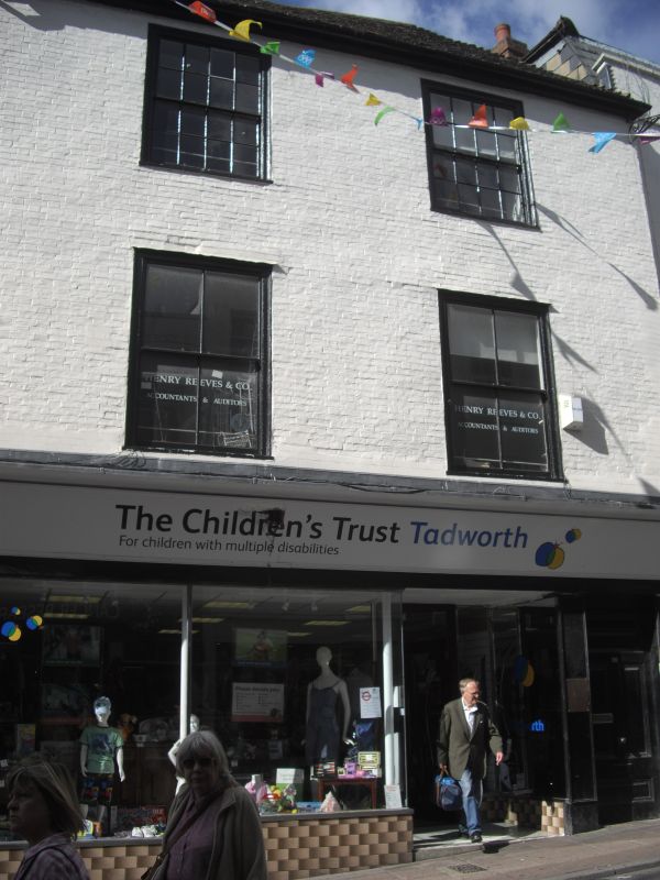
GABRIEL'S HILL
1.
5278
(South-West Side)
No 20
TQ 7655 W 2/259
II GV
2.
Early C19. 3 storeys painted brick. Hipped old tiled roof. 2 sashes set
in moulded architraves. Glazing bars intact to 2nd floor windows. Verticals
only to 1st floor windows. Modern shopfront.
Nos 4 to 20 (even) form a group.
Listing NGR: TQ7611855702
External links are from the relevant listing authority and, where applicable, Wikidata. Wikidata IDs may be related buildings as well as this specific building. If you want to add or update a link, you will need to do so by editing the Wikidata entry.


Other nearby listed buildings
