Approximate Location Map
Large Map »
Latitude: 51.2731 / 51°16'23"N
Longitude: 0.531 / 0°31'51"E
OS Eastings: 576646
OS Northings: 155709
OS Grid: TQ766557
Mapcode National: GBR PR7.32V
Mapcode Global: VHJMF.583B
Plus Code: 9F327GFJ+7C
Entry Name: 24, Ashford Road
Listing Date: 2 August 1974
Grade: II
Source: Historic England
Source ID: 1086389
English Heritage Legacy ID: 173239
ID on this website: 101086389
Location: Maidstone, Kent, ME14
County: Kent
District: Maidstone
Electoral Ward/Division: High Street
Parish: Non Civil Parish
Built-Up Area: Maidstone
Traditional County: Kent
Lieutenancy Area (Ceremonial County): Kent
Tagged with: Building
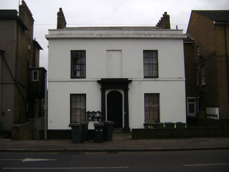
ASHFORD ROAD
1.
5278
(South Side)
No 24
TQ 7655 NE 3/88
II
2.
Circa 1820. 2 storeys stuccoed. Cornice and parapet. Stringcourse. 2 windows
and 1 window space with glazing bars intact. Doorcase with engaged Tuscan
columns, projecting cornice, segmental fanlight and door of 6 moulded panels.
Listing NGR: TQ7664655709
External links are from the relevant listing authority and, where applicable, Wikidata. Wikidata IDs may be related buildings as well as this specific building. If you want to add or update a link, you will need to do so by editing the Wikidata entry.


Other nearby listed buildings
