Approximate Location Map
Large Map »
Latitude: 51.4468 / 51°26'48"N
Longitude: 0.6215 / 0°37'17"E
OS Eastings: 582263
OS Northings: 175233
OS Grid: TQ822752
Mapcode National: GBR QQK.7XS
Mapcode Global: VHJLH.QWDS
Plus Code: 9F32CJWC+PH
Entry Name: Court Lodge Farm House
Listing Date: 14 November 1986
Grade: II
Source: Historic England
Source ID: 1086503
English Heritage Legacy ID: 172919
ID on this website: 101086503
Location: Stoke, Medway, Kent, ME3
County: Medway
Civil Parish: Stoke
Traditional County: Kent
Lieutenancy Area (Ceremonial County): Kent
Church of England Parish: Grain St James
Church of England Diocese: Rochester
Tagged with: Farmhouse
STOKE CP
TQ 87 NW
3/82
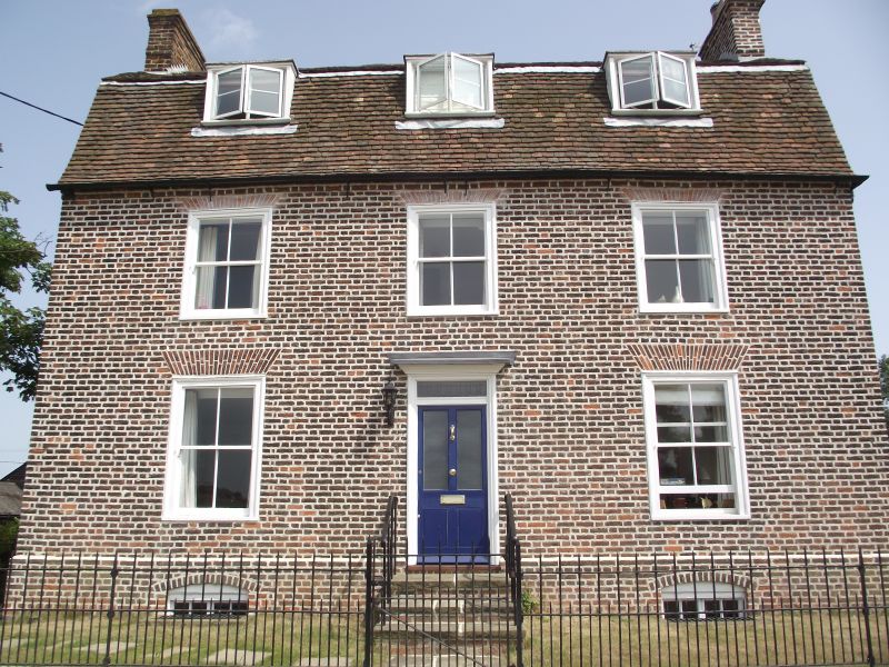
Court Lodge Farm House
GV II
Farmhouse. Late C18. Red brick with plain tiled gambrel roof. 3
flat-headed dormers and stacks on gable parapets. 2 storeys and attic.
3 window front, glazing bar sashes with gauged heads and open boxes.
Central entrance with half-glazed door, transom-light and cornice over.
C19 additions to rear.
Listing NGR: TQ8226275230
External links are from the relevant listing authority and, where applicable, Wikidata. Wikidata IDs may be related buildings as well as this specific building. If you want to add or update a link, you will need to do so by editing the Wikidata entry.


Other nearby listed buildings
