Approximate Location Map
Large Map »
Latitude: 53.3532 / 53°21'11"N
Longitude: -2.6366 / 2°38'11"W
OS Eastings: 357722
OS Northings: 384228
OS Grid: SJ577842
Mapcode National: GBR BY0N.ZP
Mapcode Global: WH98Q.GZP6
Plus Code: 9C5V9937+79
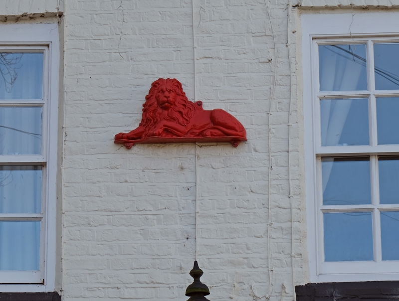
Entry Name: The Red Lion Public House
Listing Date: 31 October 1983
Grade: II
Source: Historic England
Source ID: 1086982
English Heritage Legacy ID: 56009
ID on this website: 101086982
Location: Moore, Halton, Cheshire, WA4
County: Halton
Civil Parish: Moore
Built-Up Area: Moore
Traditional County: Cheshire
Lieutenancy Area (Ceremonial County): Cheshire
Church of England Parish: Daresbury All Saints
Church of England Diocese: Chester
Tagged with: Pub
SJ 58 SE MOORE C.P. RUNCORN ROAD
(South Side)
6/55 The Red Lion Public House
II
Public House late C17 with alterations, whitened brick with slate roof
2 storeys 4 bays. Brick band three courses deep at first floor level.
Boarded entrance door, arched entrance with blank fanlight, renewed
casements. Wooden bracketed cornice.
Interior bevelled beams and inglenook beam.
Listing NGR: SJ5772284228
External links are from the relevant listing authority and, where applicable, Wikidata. Wikidata IDs may be related buildings as well as this specific building. If you want to add or update a link, you will need to do so by editing the Wikidata entry.


Other nearby listed buildings
