Approximate Location Map
Large Map »
Latitude: 54.2985 / 54°17'54"N
Longitude: -2.8694 / 2°52'9"W
OS Eastings: 343515
OS Northings: 489563
OS Grid: SD435895
Mapcode National: GBR 8LDQ.LV
Mapcode Global: WH830.W7S0
Plus Code: 9C6V74XJ+C6
Entry Name: Limekiln at SD 435 895
Listing Date: 3 April 1989
Grade: II
Source: Historic England
Source ID: 1087119
English Heritage Legacy ID: 77091
ID on this website: 101087119
Location: Westmorland and Furness, Cumbria, LA8
County: Cumbria
District: South Lakeland
Civil Parish: Crosthwaite and Lyth
Traditional County: Westmorland
Lieutenancy Area (Ceremonial County): Cumbria
Church of England Parish: Crosthwaite St Mary
Church of England Diocese: Carlisle
Tagged with: Lime kiln
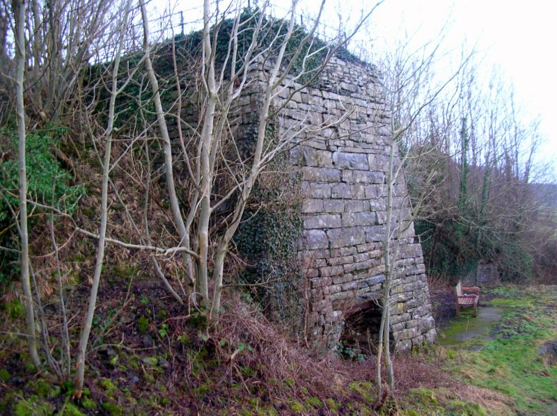
CROSTHWAITE AND LYTH
SD 48 NW
3/3 Limekiln at
SD 435 895
II
Limekiln. Probably C19. Dressed limestone. Square on plan. West fire hole
has canted sides and lintels with iron beams. Charge hole filled in.
Listing NGR: SD4351689563
External links are from the relevant listing authority and, where applicable, Wikidata. Wikidata IDs may be related buildings as well as this specific building. If you want to add or update a link, you will need to do so by editing the Wikidata entry.


Other nearby listed buildings
